Interesting weather images
-
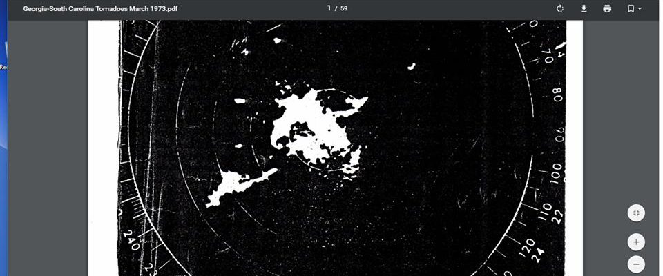
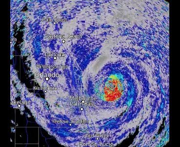
Our NWS radar has come a long ways from the days of the old black and white radars! Now we have dual-pol doppler radar in multi-color with all kinds of bells and whistles, but this image shows what they had to work with in 1973. The hook echo just to the southwest of the center…
-
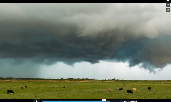
I am a sucker for time lapse videos of clouds. The World Meteorological Organization has a new one called “Understanding Clouds” with some spectacular footage of clouds. I think the title of the video is a big misleading because the clouds are just shown with dramatic music rather than an explanation of how clouds are…
Posted in: Interesting weather images -
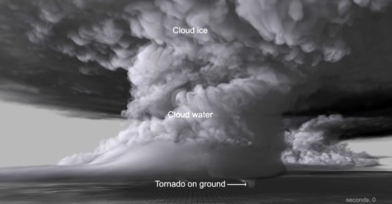
Here is a link to a fantastic video of a supercell thunderstorm simulated by a supercomputer. The work was done by Dr. Leigh Orf, who was a graduate student at University of Wisconsin-Madison at the same time I was. He is now doing these super in-depth visualizations of supercells and discerning how they form and…
-

The South Carolina State Climate Office, in conjunction with other cooperators, has released an online story map of the disastrous flooding in October 2015 that has won several awards for its report. You might like to take a look at it. It contains information about the setup for the flood, which included the impacts of…
-
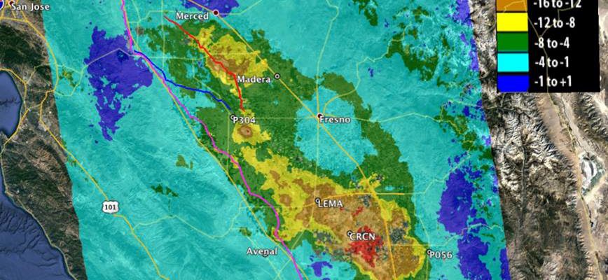
From NASA’s web page: “Since the 1920s, excessive pumping of groundwater in California’s San Joaquin Valley has caused land in sections of the valley to sink by as much as 28 feet (8.5 meters), a problem exacerbated during droughts, when farmers rely heavily on groundwater to sustain one of the most productive agricultural regions in…
-

NASA posted a new photo of fires that are burning around the Southeast. Many of these fires are prescribed burns for people clearing land in preparation for field work. Others are wildfires which have grown due to recent dry conditions. You can read about the latest photo and view it at https://www.nasa.gov/image-feature/goddard/2017/fires-in-southeast-united-states-both-wild-and-prescribed.
-
Weather Underground posted a story today describing some of the non-precipitation things that have shown up on National Weather Service radars across the nation. I’ve shared some of them before but you might be interested in seeing the full list. You can see images and access the information at https://www.wunderground.com/news/radar-gaggle-geese-arkansas-iss?__prclt=FNouhSlu.