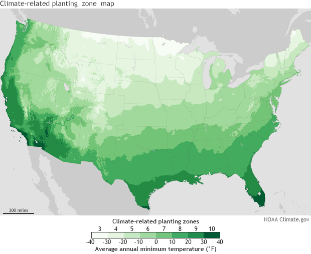
Here’s an interesting article from Fivethirtyeight.com about why NOAA and USDA have slightly different plant hardiness zone maps. These maps help gardeners determine what kind of plants are likely to do well in a given location and are based primarily on lowest minimum temperatures. Because of the way they are calculated, the two maps show some differences. You can read about it and see both comparisons between the two maps and projections for what they might look like in the future at https://fivethirtyeight.com/features/two-government-agencies-two-different-climate-maps/?ex_cid=story-twitter.