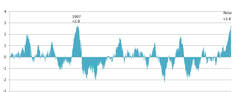
This week the current strong El Niño tied the all-time sea surface temperature record of 2.8 degrees C above the long-term average with 1997, the record-holder for the strongest El Niño. Since the current El Niño still looks like it will grow for another month or two before it starts its inevitable decay, it should become the new record-holder for the strongest temperature anomaly in the eastern Pacific Ocean in the next few weeks.
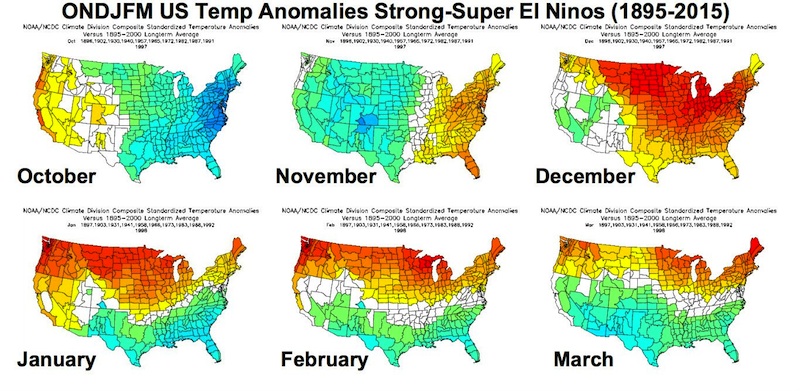
Weather Underground has an intriguing story about how this El Niño may affect December temperatures. Composite maps from previous super-strong El Niños show that, based on those composites, December is likely to be quite a bit warmer than normal, with a shift to the cooler and cloudier conditions in January through March. This means that if snow or ice storms occur in the Southeast, they are most likely later in the winter rather than in the next couple of months. Interestingly, the strong El Niño is linked to better skiing in the North Carolina mountains, so if you like to ski locally, this might be a good year for you later in the winter.
If you’re interested in the latest on El Niño impacts in California, you may be interested in this story from the San Jose Mercury News. Most likely the best relief from the persistent drought will be in southern California with more limited relief in the north, where the biggest reservoirs are located. The Los Angeles Times also has an article describing the likely winter conditions in California here.