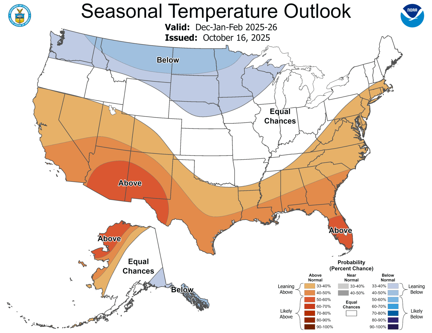
NOAA released the latest set of seasonal outlook maps today, although there was no accompanying press release or other publicity generated due to the current government shutdown. The maps for the December through January period show a pattern that is very typical for a La Nina, with warmer and drier than usual conditions occurring along the southern part of the region as the jet stream is shifted north towards the Ohio River Valley. (Note that in their winter outlook they skipped the usual 3-month maps for November through January; you can see them at https://www.cpc.ncep.noaa.gov/products/predictions/long_range/seasonal.php?lead=1). If you are interested in reading about how they came up with the maps they did, there is a good discussion at https://www.cpc.ncep.noaa.gov/products/predictions/long_range/fxus05.html.
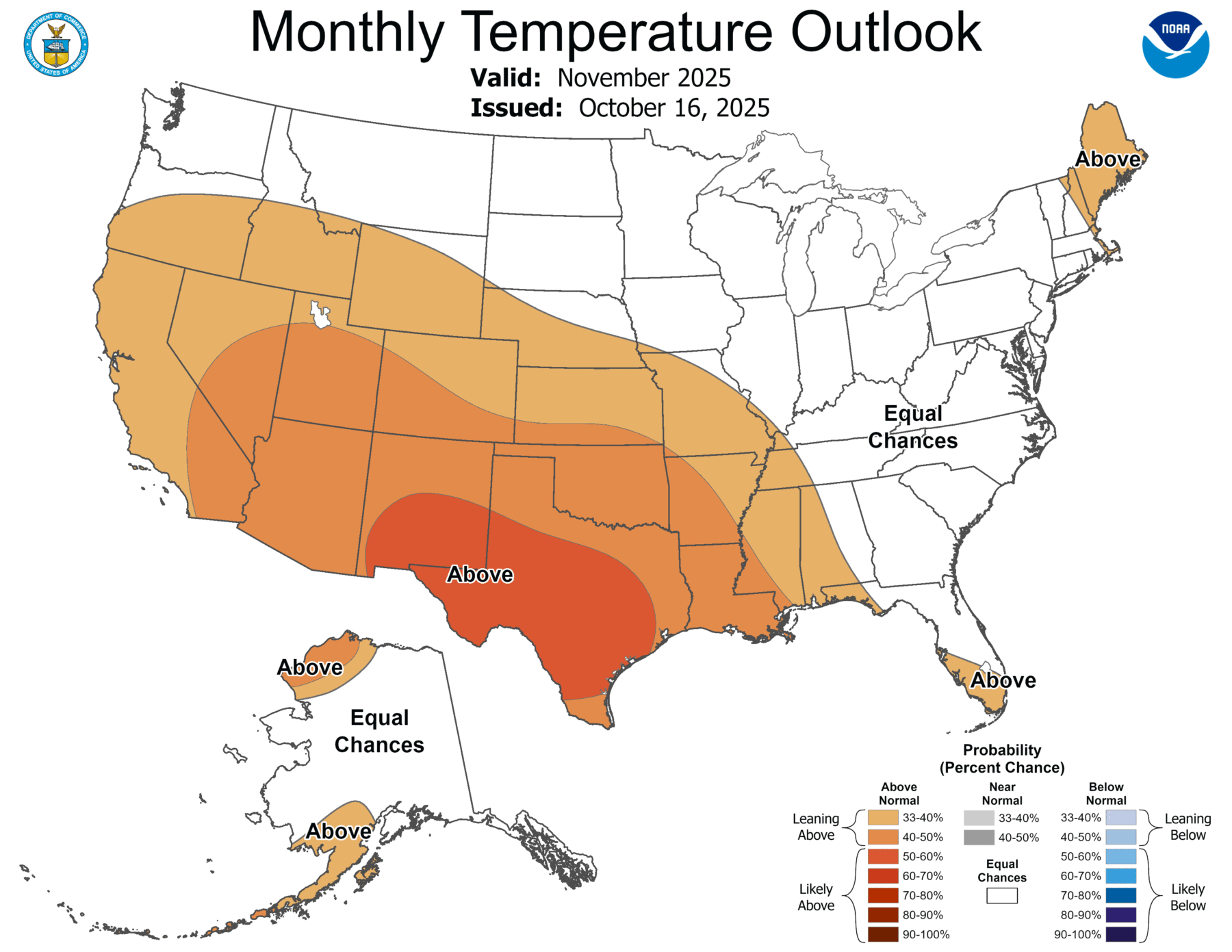
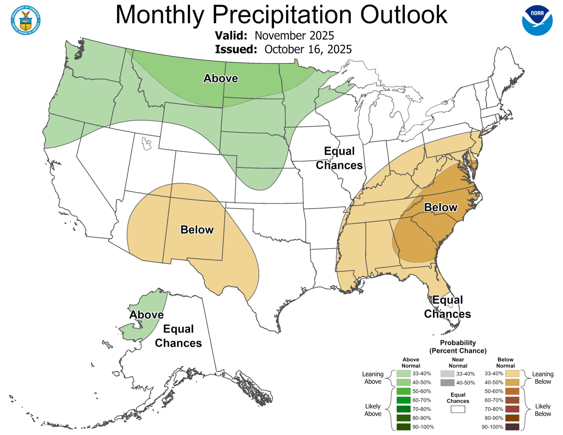
The maps show that November is a transitional month and there is no clear signal for temperature this month but conditions are expected to continue to be dry. The maps for the December through February period show the typical La Nina pattern of warmer and drier conditions in southern Alabama and Georgia and down into Florida, with less clear conditions expected farther north in the Ohio River Valley and adjacent areas to the south, which could include parts of Tennessee as well as northern AL and GA. Keep in mind that warm and dry conditions will not occur every day during the period and we could still see some cold outbreaks. Also keep in mind that this is a statistical forecast so even if it is correct in most La Nina winters, we could still experience something else depending on other conditions that affect global weather.
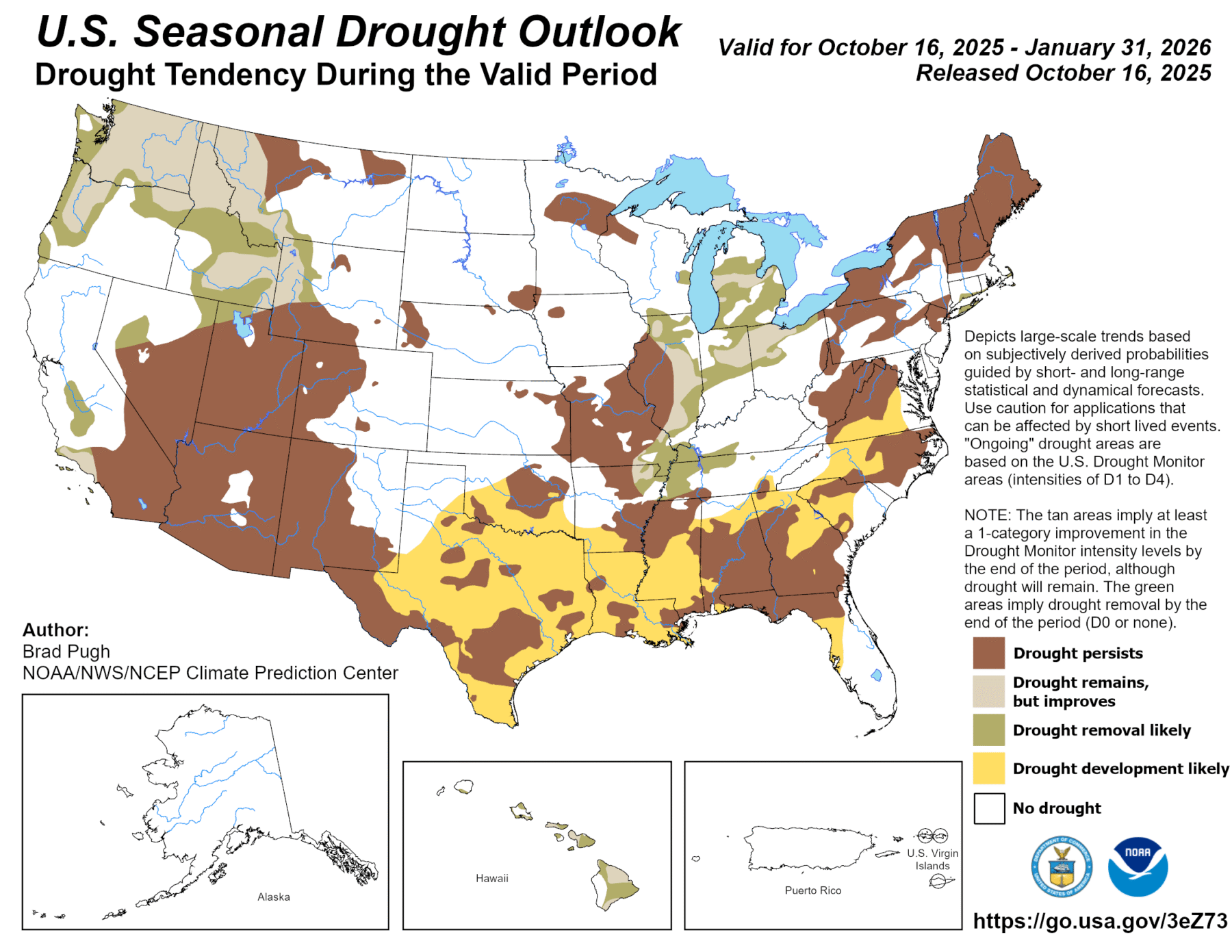
The result of the expected warmer and drier conditions is that drought is also expected to expand in the region through the winter. That could bring dry soil to the region in early spring, which might be good for field work but bad for germination of seeds if the dryness persists into the growing season.