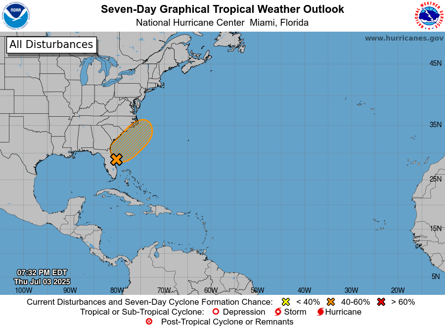
Over the last two days the front has pushed through a lot of the Southeast and an area of low pressure is forming along the nearly stationary front in NE Florida. This low is expected to drift east or northeast over the Atlantic Ocean, where it has a 60% chance of becoming Tropical Storm Chantal. If it does, it is going to be mainly a rainmaker for Florida and the areas right along the East Coast, but the rain is not expected to reach very far to the west. If you are vacationing along the northern Gulf Coast, at this point it looks like you are mainly in the clear and should have a beautiful weekend. If you are along the coasts of Georgia and the Carolinas, it could be wet and gusty, but once you get away from the coasts you are not likely to see much rain, especially in Georgia. The steering currents are pretty light so the low is not going to move very fast but will spin around off the Georgia and SC coast before moving north and potentially coming onshore late in the weekend or early next week.