I am sending this early on Thursday because I will be traveling this weekend and may not have access to the internet later this weekend.
The latest tropical update has increased the chances of tropical development in the SW Atlantic to 40% over the next two days. Whether or not it gets named, we are likely to see wet conditions in the southern half of Georgia, especially along the southeast coast, starting on Friday. The northeast coast of Florida will also be hit and southeastern Alabama may also experience effects from the storm later in the week. I expect most of the southern half of Georgia and northeastern Florida will get a half inch or more over the next seven days, with less if any to the north (they will get more next week). Potentially you could get several inches in parts of southern GA at some locations although it may be scattered. The southeast GA coast near Jekyll Island could get several inches of rain from the storm. Other impacts could be rip tides and high waves along the coast as well as some gusty winds in the area where the storm moves.
Since I may not be able to monitor the changing forecasts, please follow the National Hurricane Center at https://www.nhc.noaa.gov/ and use your local National Weather Service forecasts (you can get them from https://www.weather.gov/ using the box at top left) to pinpoint the timing and impacts of the storm. Enjoy the rain if you get it and use this as practice for preparing for a later storm this year.
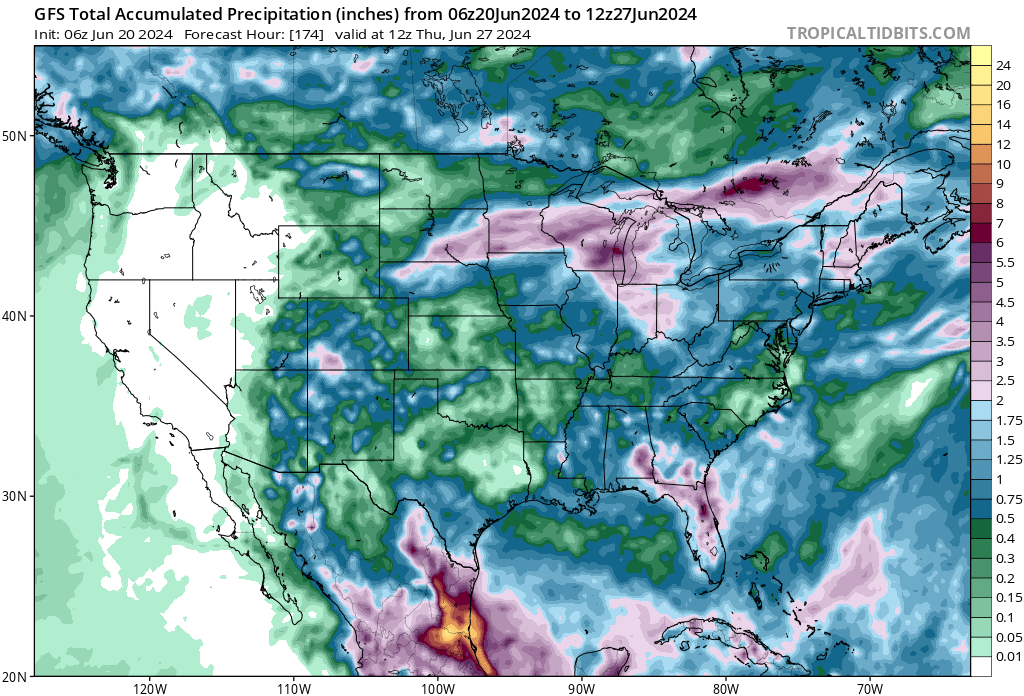
The map below shows the predicted rainfall through next Thursday morning according to the GFS. Note that the actual amounts will vary depending on exactly where the storm moves.