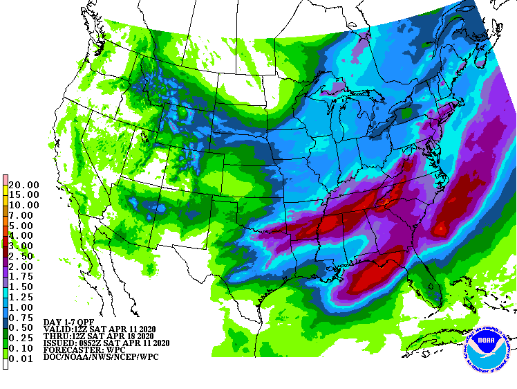
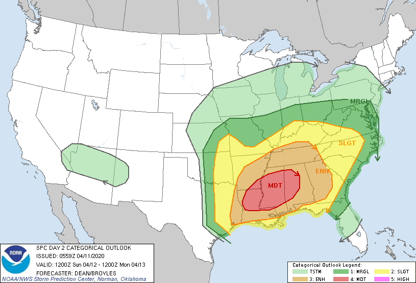
The latest 7-day QPF map shows two areas of heavy rain this week. The northern streak is linked to the major storm that will pass through our area on Sunday, bringing not only rain but a significant chance of severe weather, including high winds, hail and long-track tornadoes. (I will post separately on this later today too.) The highest probability of severe weather will be in MS and AL, but GA and northern FL are also likely to be impacted. As the strong front moves through the area on Sunday night into Monday morning the most likely area of severe weather will shift to the east along the coast. The trailing front will linger in Florida, bringing heavy rain to that area early in the week. Mostly dry weather should return to the region by mid-week.