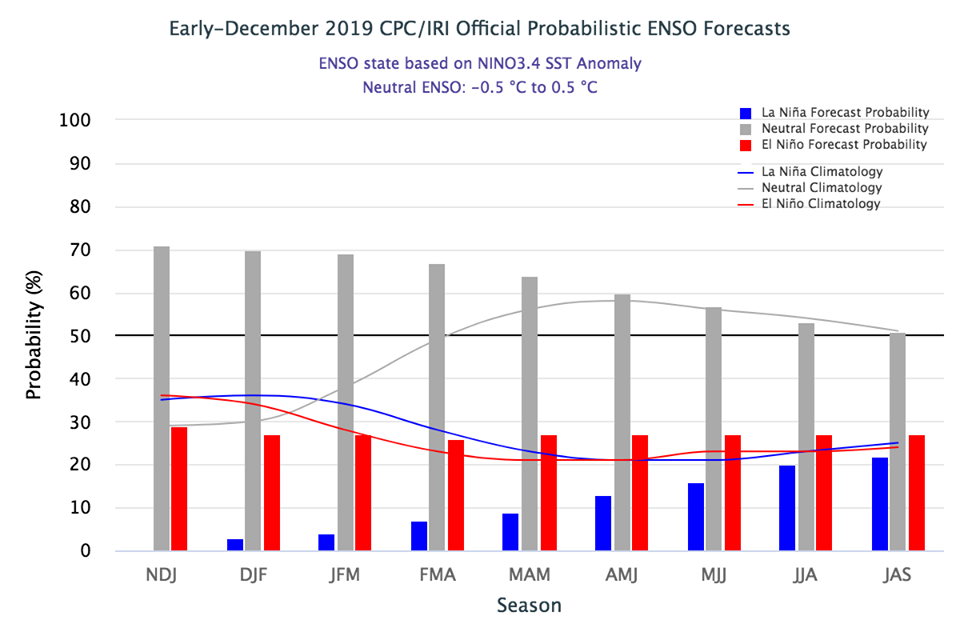
The latest outlook for El Niño was released this morning by NOAA. It shows that ENSO conditions are currently neutral and are expected to remain so for at least the first half of 2020. In the Southeast neutral winters generally have more swings in temperature between warm and cold episodes because there is less influence from the tropical Pacific and more influence from other parts of the globe. Sometimes a particular atmospheric wave pattern can lock in and bring a protracted episode of either cold or warm conditions (depending on what part of the pattern we are in) to the region, but that is not predictable on long time scales.
Depending on exactly how the patterns set up this year, we could see ample chill hours for fruit or (if we go into a warm pattern) fewer chill hours. We do know that with the increase in swings in temperature that a late frost is more likely in a neutral year, so that will be a concern for fruit producers if we have good chill hours followed by a warm February. The long-term trend in temperature in winter continues to rise like other parts of the country and world.
You can read the latest bulletin here.