If you use USGS streamflow, groundwater, or precipitation data, you will want to know about this. USGS is going through a modernization process and will be ending much of their pre-calculated statistics information by the end of 2025 or very early 2026. Thus, WaterWatch will be decommissioned. Realtime and monthly (for the prior month) streamflow percentiles will still be available but USGS’s running 7-, 14-, and 28-day average streamflow percentiles will not be available anymore. This also means that these maps (other than realtime streamflow) will no longer appear on Drought.gov. According to Elliot Wickham, NIDIS | Southeast Regional Drought Information Coordinator, the USGS does provide documentation and instructions for pulling this data yourself through different script packages, which is discussed in this blog post. However, you would need to take the historical streamflow data and calculate your own percentiles. It is not yet clear how much of the data will disappear, so things like Site Duration Hydrographs or Area Duration Runoff Hydrographs, as well as other functions, may still exist. However, given that their blog post says that WaterWatch will be fully decommissioned, you should prepare for all of the functionality, data, and tools for streamflow monitoring to be decommissioned in the near future. You may find it useful to look through past information or sign up for USGS quarterly newsletters.
NIDIS is planning on sending out some information about this next week, and you can reach out to USGS at gs-w_waterdata_support@usgs.gov if you have questions about the changes.
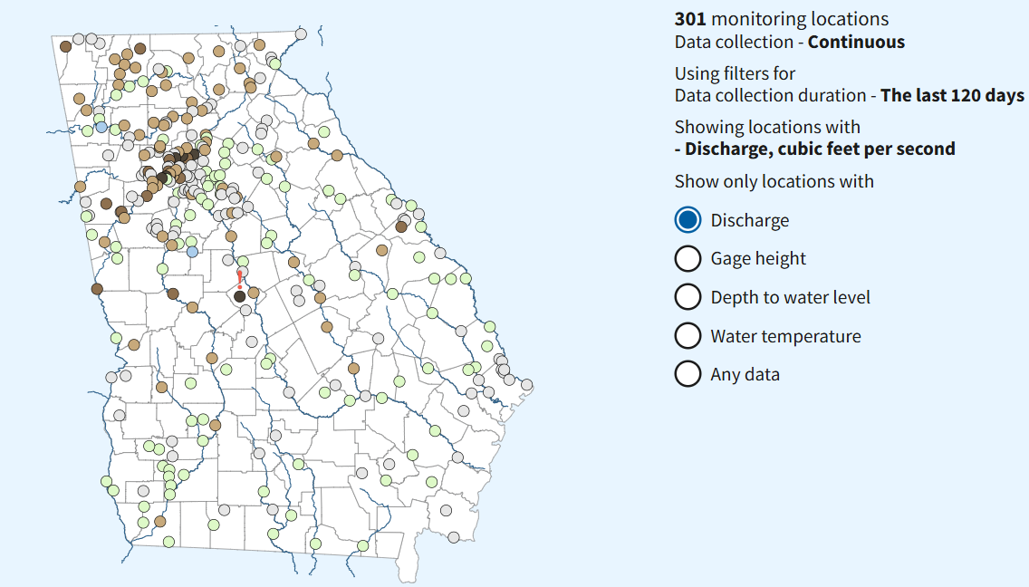
According to Elliot, the USGS National Water Dashboard will probably be the new go-to data tool for getting streamflow data. However, the USGS has individual state pages in their Water Data for the Nation toolkit. He provide the link for each state below. These state pages allow you to view streamflow conditions (as well as other data) by state. One cool function is that it allows you to view streamflows by either county or by watershed. Also, for gauges with enough data, it provides an easy way to view the real-time hydrograph. USGS has also been working on a new Water Data API.
USGS State Pages: