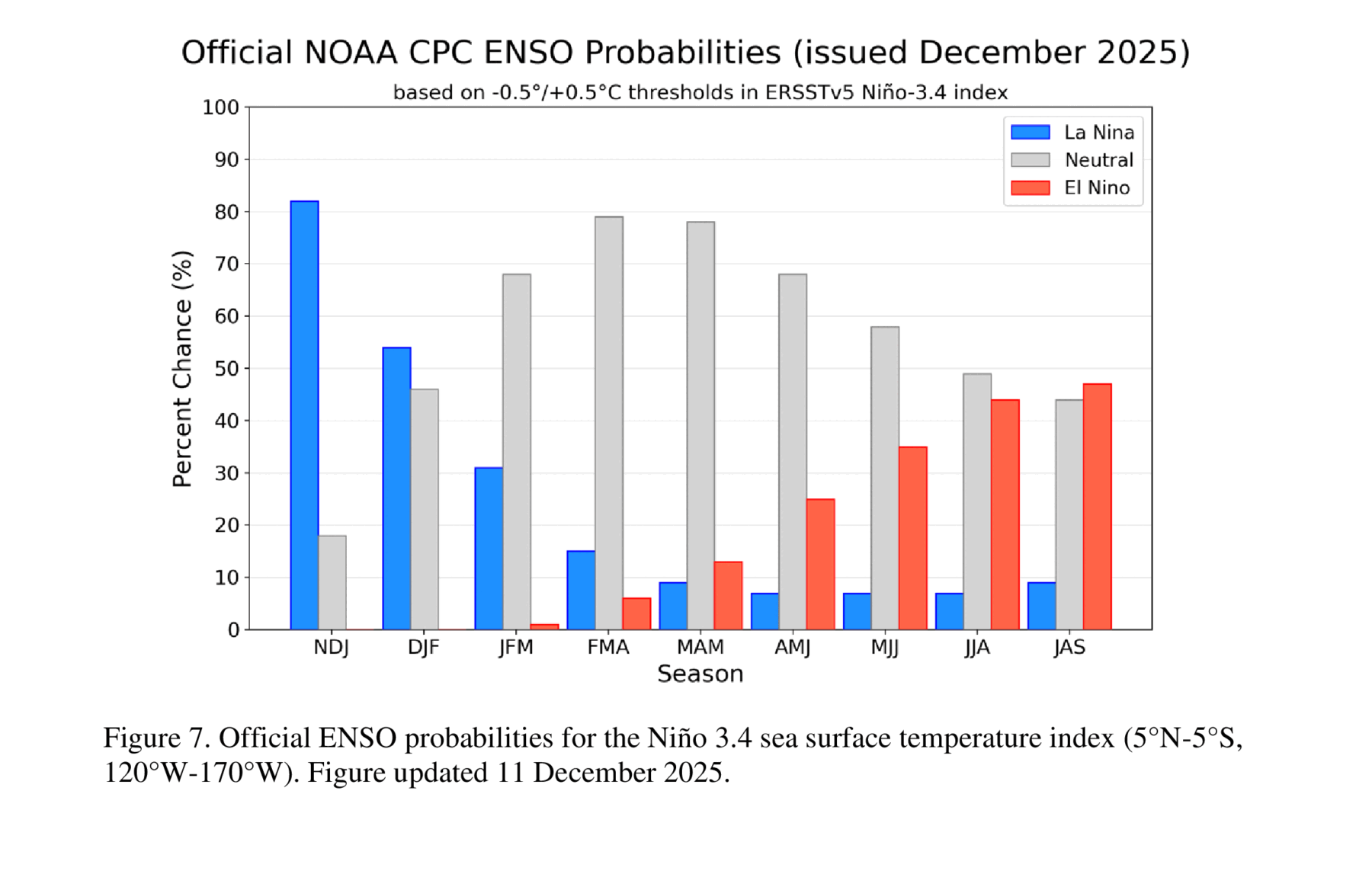
The latest ENSO discussion from NOAA’s Climate Prediction Center was issued today. It shows that the current weak La Nina is expected to continue for the next couple of months with a transition back to neutral conditions likely in the January-March period. By midsummer it is possible that we will swing the other way into an El Nino. The impacts of this forecast are that the remainder of winter in the Southeast is likely to be warmer and drier than usual, especially in south AL and GA and in Florida. There could still be some cold outbreaks due to other climate factors like the possibility of a sudden stratospheric warming event, though. There are no strong signals for the climate in neutral conditions in spring, but more swings in temperature are likely, and that could mean a late frost is more likely to occur if a cold outbreak hits later in spring after warm weather has caused fruit to leave dormancy and bloom. An El Nino during the next hurricane season could mean fewer storms in the Atlantic because of increased wind shear aloft that would reduce the ability of seed storms to develop. But as we all know, it only takes one hitting at the wrong spot to cause tremendous damage so even if El Nino occurs, producers should still take preventive action like inventories ahead of the next hurricane season.