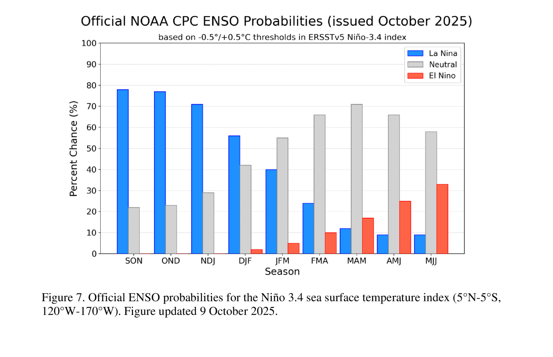
In September, the cooler-than-normal ocean temperatures in the eastern equatorial Pacific Ocean expanded and La Nina conditions were officially declared in today’s ENSO briefing by NOAA’s Climate Prediction Center. The La Nina is expected to last through winter, with a transition back to neutral conditions in early spring. The models generally agree that this will be another weak event, which means that the strongest impacts are likely to be in southern Alabama and Georgia and south into Florida, with less predictable climate in northern parts of the region.
In a La Nina, the jet stream usually shifts to the north, leaving the Southeast warmer and drier than usual with more sunny days. I expect this pattern to be shown in the seasonal outlook that comes out in about a week. But in a weak event, it may not shift that far to the north, and locations in northern AL and GA as well as the Appalachians could see wetter and colder than normal conditions occur if the La Nina remains weak. Areas that stay warmer than normal over the winter may have more problems with overwintering pests and diseases, especially if we don’t have any cold outbreaks that break up the warm conditions and chill the ground.
If we get moisture back into the soil soon, it would be a good idea to test for nematodes this fall so that you can plan ahead to treat during next spring’s planting, according to Bob Kemerait, UGA plant pathologist, since they could be more of a problem next year if the winter stays mild. Last winter was also a weak La Nina, but we had a couple of cold outbreaks associated with snow storms that caused the soil to freeze long enough to reduce the overwintering impacts. Producers in the areas most likely to be affected by warmer and drier conditions over the winter should keep in mind that the soil may warm up earlier than usual next spring and dry conditions may make it easier to get into the fields, but soil moisture could be lacking, which could affect germination of seeds and establishment of crops.