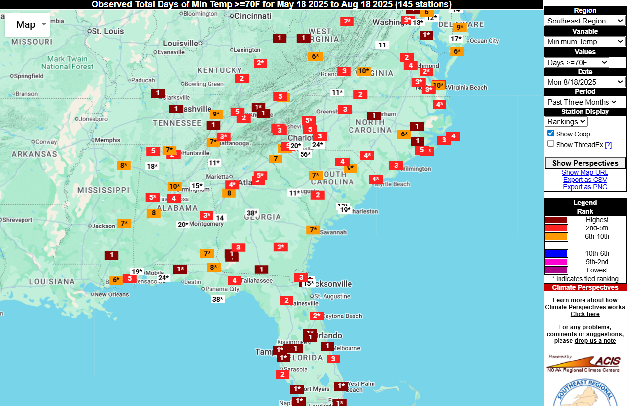
One indication of how hot and humid it has been for most of the summer this year is the number of nights that have never gotten below 70 F. For many stations, this 3-month period has been consistently well above normal in minimum temperatures due to a combination of rising temperatures globally and the increased humidity we have also seen this year with frequent showers in many locations. You can see this in the Southeast Regional Climate Center’s Perspectives tool as seen below. I turned off the long-time ThreadEx records to make the map a little less crowded but you can see that at many locations in red, the stations are in the top 5 years for the number of nights at 70 F or higher. Even adding back the longer-term stations does not change the overall picture much. You can try it out for yourself at https://sercc.com/climate-perspectives/. Minimum temperatures are rising at twice the rate of maximum temperatures due to both increases in humidity and some contribution from urbanization, since lots of concrete and other city surfaces can trap heat and release it overnight, keeping temperatures higher than rural locations.