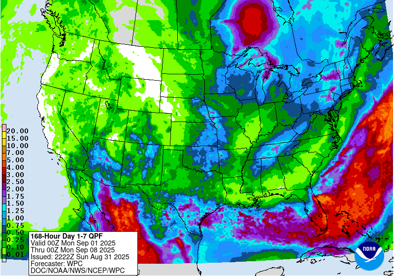
The latest 7-day QPF map shows that rainfall amounts over most of the region will be very light this week as the main source of rainfall will be a front that is stretched across the Florida peninsula. The only place that is expected to get significant rainfall is the southern half of the Florida peninsula, where rain could be quite heavy. There will also be some afternoon thunderstorm activity in the Appalachians on some days. The pattern of most rain in the southern part of the region is expected to continue for the next three weeks, although the area of rain could inch farther north and include southern parts of AL and GA as well as the Florida Panhandle. Cooler temperatures will also continue for this week but they should be rising to normal in week 2. There is no good signal for temperature in weeks 3 and 4. The tropics also continue to be quiet and the high pressure over us in the Southeast should fend off any storm passages in the next week or so.