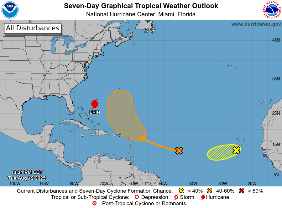
The latest 7-day tropical outlook shows that Erin is still on course to turn north and then northeast, passing between the US East Coast and Bermuda. But the track has been shifting a little to the west, which means that the Outer Banks of NC could see more wind and rain than previously predicted even though the center of Erin will stay well offshore.
The wave following Erin still has a 60% chance of becoming a named storm in the next week, but due to interactions with the circulation around Erin and a strong trough of low pressure that will be moving off the East Coast, it is now expected to swing north even earlier than Erin did and is not expected to affect the United States much at all.
The next wave, far out in the eastern Atlantic, looked healthy to start with but is expected to move into an area of cooler water temperatures and more wind shear and has only a 30% chance of becoming a named storm in the next week. Even if it does, it will be close to two weeks before it could cross the Atlantic and affect the US, and there is a good chance it will weaken or steer away from us, especially with the presence of the trough pushing any storms to the NE before they get to shore.