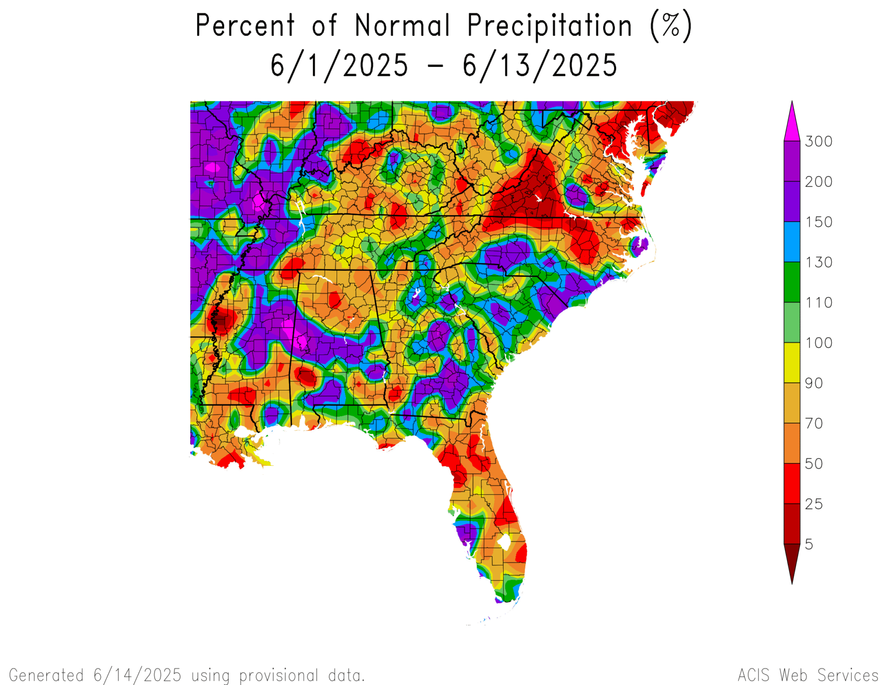
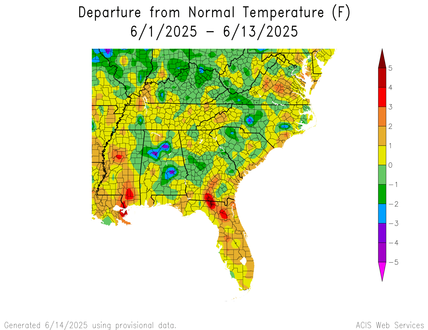
Since we are halfway through June, here is a quick look at what temperature and precipitation have been observed so far. The precipitation has been quite variable with all of the convective rain events we have been having. I went to Kansas City this past Tuesday for a climate conference and was delayed leaving by thunderstorms developing over ATL and when I returned today, we were again delayed by storms at the airport. Some areas of the region, including a number of areas in Georgia, received over ten inches of rain in just a few days, while other areas were largely missed, resulting in a patchwork of dry conditions that is not always shown well on the Drought Monitor maps. A lot of the Florida Peninsula is dry along with northern Alabama, far SW Georgia, western Virginia, and northern and NE North Carolina. Other areas have received much above normal rainfall. Temperatures have varied across the region as well, but there is a pretty good correlation between where the most rain fell and where the temperatures were cooler. This is probably related to cooling by cloudy conditions associated with the rain as well as rain-driven evaporative cooling. We should get new monthly and seasonal outlook maps sometime this coming week.