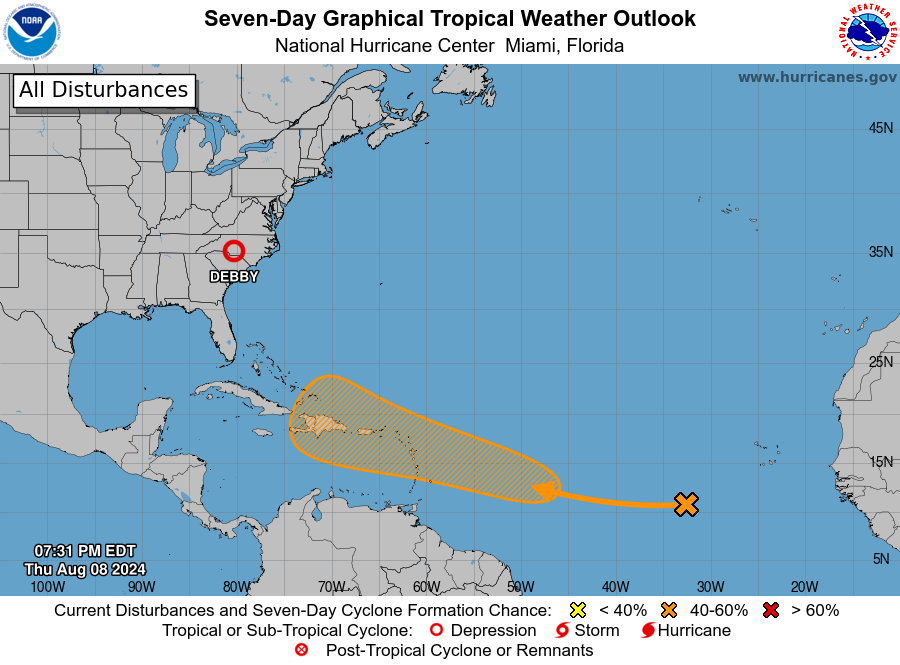
Now that Debby is down to a tropical depression and headed out of our region soon, it is time to look ahead to see what is ahead. The National Hurricane Center has another area with a 50% chance of development in the next week somewhere in the western Atlantic. Since there is no center yet, it is difficult to forecast where it will go, but many of the models are predicting that it may turn north before it reaches the East Coast. However, there are models that bring it into the Gulf, so we need to watch it carefully to see what will happen as it becomes more developed. Fortunately, it will be at least a week before it gets close enough to make any management decisions, so that will give producers time to recover from Debby and assess what they need to do next. Remember, the forecast for the number of named storms has the number of storms at around 20-25 this year, which means we may go most of the way through the alphabet before the season is done. If we look at the satellite images over Africa, we can see more waves developing and moving west, and those may become the seeds of the next storms to head our way.
