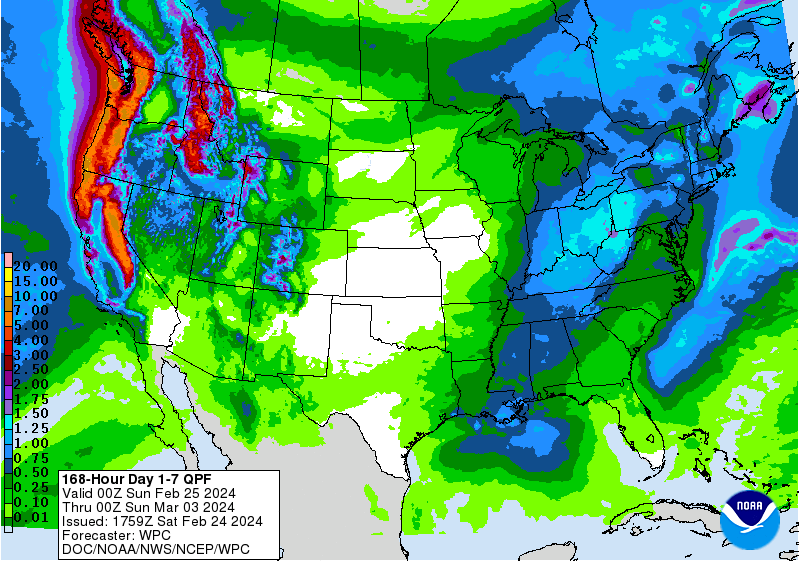
The latest 7-day QPF map shows that most areas of the Southeast will see some rain this week but most areas will only see showers, not significant amounts. A system moving out of the northern region today is bringing a little snow to higher elevations and some rain to NC and VA. Midweek, the northern areas will see more rain, with the highest amounts in the mountains and NC and VA. Late in the week, the rain will shift to southern parts of the Southeast, although southern Florida is likely to see very little rain. Temperatures will be cool for the next few days and then warm up. Week 2 is likely to be warmer and wetter than normal across the region. Frost is likely tonight north of the Fall Line. There are a couple more chances of freezing weather in VA and NC and a little bit of higher elevation GA, AL, and SC, but no widespread freeze event is seen in the long-range models through the second week in March. There is still plenty of cold air bottled up to the north so we will be watching that carefully for signs of another cold outbreak later in March.