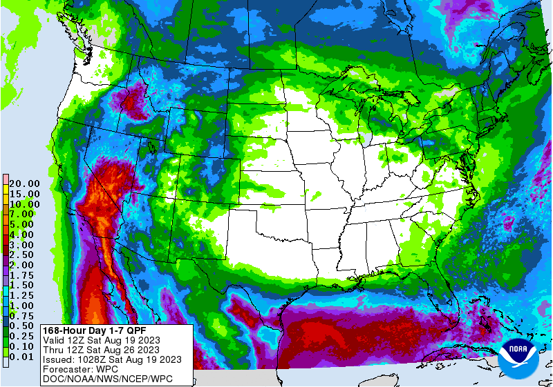
The latest 7-day precipitation outlook for the Southeast shows that most areas of the region other than Florida will get little to no rain in the next week. Most shower activity that occurs will be late in the week. This is due to a big area of high pressure that will dominate the weather pattern across the eastern 2/3rd of the United States this week. While temperatures are fairly mild for August, the heat and humidity will increase over the weekend, leading towards hotter temperatures next week. So far, the prediction for Week 2 also shows the likelihood of dry conditions, although temperatures may be somewhat lower than this week.
The Atlantic tropics have become quite active, with four different centers of possible development in the next week. Fortunately, most of them look like they not will affect us, although southern Florida could see some rain from the system that is moving west into the Gulf on its way to Texas. Meanwhile, the circulation around the high pressure center is helping direct the rain from Hurricane Hilary towards southern California, where some areas could see several years’ worth of average rain falling in just a day or two.