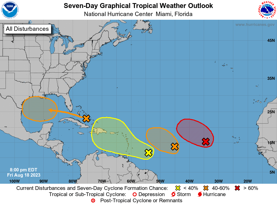
Now that we are approaching the peak season for Atlantic tropical storms and hurricanes, suddenly the National Hurricane Maps have become a lot more interesting. Today’s 7-day outlook shows four different potential areas of development. Fortunately for us in the Southeast and western parts of the basin, the two eastern storms, which are the most likely to develop into named storms, are both likely to stay over water and not affect the United States at all, although the more western of those two could clip Puerto Rico and the Virgin Islands. The area of potential development currently moving into the Gulf of Mexico is projected to keep moving west and is likely to bring beneficial rain to parts of Texas and nothing to the Southeast. The fourth center that is currently north of South America has a low chance of developing over the next week so there are no immediate concerns there either.
Meanwhile, the eyes of all tropical meteorologists right now are concentrated on Category 4 Hurricane Hilary in the Eastern Pacific, which is expected to weaken before it comes onshore but is likely to bring flooding rains to parts of Southern California. Some areas could receive several years’ worth of average rainfall in just a few days. The last storm similar to this one hit there in 1939. You can read more at https://www.cbsnews.com/news/hurricane-hilary-forecast-california-tropical-storm-nearly-unprecedented/.