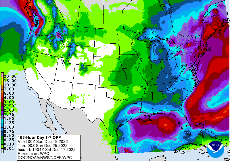
The latest 7-day QPF map shows that most of the rain this week will occur near or off the coasts. Over the weekend, the heaviest rain will fall near the Gulf Coast, but by mid-week the focus will shift to the East Coast. A storm is likely to develop there and could bring winter conditions to parts of the region, especially more northern areas, but there is still a lot of uncertainty about the timing and amounts of precipitation. Some of it may be snow but how much and where is still too far out to say. For the rest of us, it will be mostly dry and very cold, with the lowest temperatures likely to be on the morning of December 23 before they start their climb again. Make sure you have a way to get heat and protect your livestock and pets from the cold air.
If you are traveling you will want to watch the forecast carefully, because even if the weather is not bad in your location, if you are driving or flying it could still be affected, especially in the Northeast. You can view potential winter storm impacts at https://www.wpc.ncep.noaa.gov/wwd/wssi/wssi.php as we get closer to Christmas.