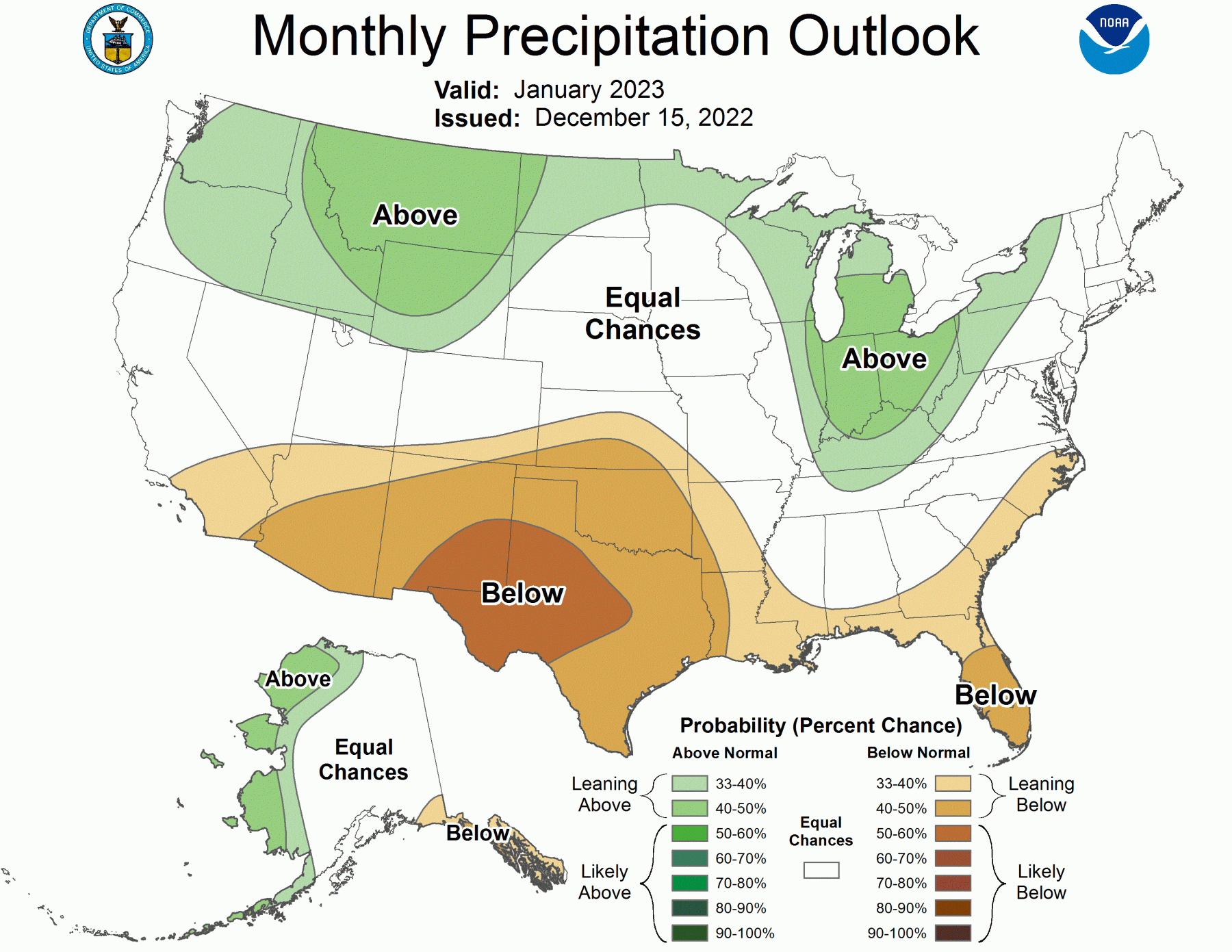
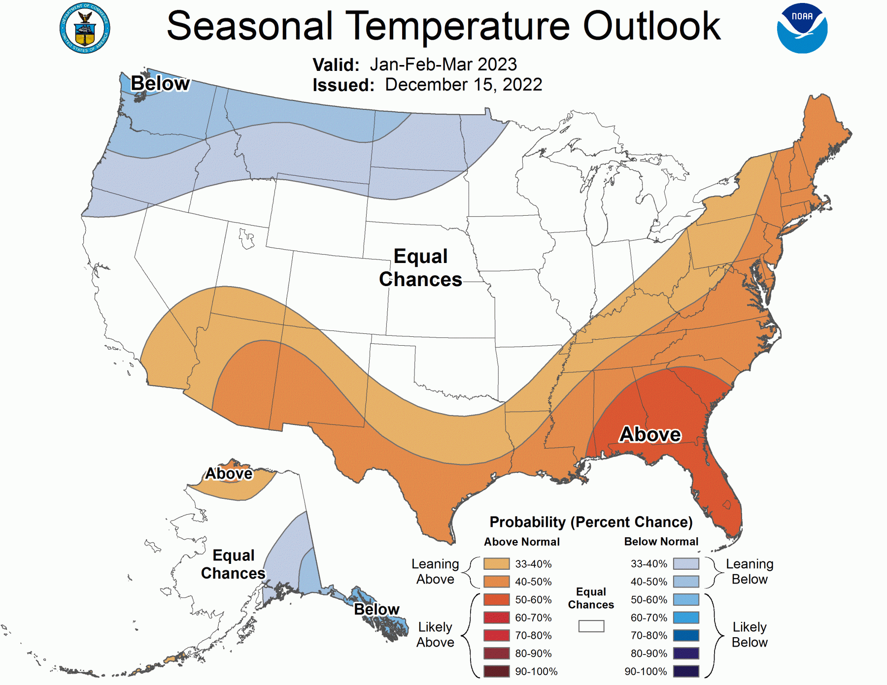
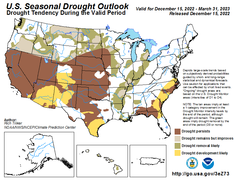
The latest seasonal outlook for January through March 2023 was released earlier this week. It shows that the expected climate pattern for the winter as a whole is still a La Nina pattern, with warmer and drier conditions expected, especially in Florida and South GA and FL. Keep in mind that this prediction is based largely on statistics, and while most La Nina years may follow this pattern, not all of them do. Or it could be that the cold outbreak we will experience in the next two weeks over most of the Southeast will be the coldest period of the winter and warmer conditions will return in January. Also note that the pattern is conducive to an expansion of drought along the Coastal Plain over the next three months, which could mean that those areas will start the growing season with a water deficit just when they need it for planting.
If you are a fruit farmer, you can expect to see a rapid increase in the accumulation of chill hours. That will make the plants ready for blooming once a warm spell occurs, and that could be a problem if we switch back to a colder pattern later in spring. Of course, it is much too early to know if this will happen, but it is something to watch for. Meanwhile, prepare for very cold air occurring with the bottom likely to be around December 23. A winter storm somewhere in the region is quite likely but it is too early to say where it will be or how much snow and ice it might bring, so keep your eyes and ears on the forecasts from official sources like the National Weather Service.
Do not trust your apps on your smartphone for detailed and accurate information! I have seen a number of Tweets in the last few days talking about how poorly their apps have been behaving in this tricky weather situation. Also beware of non-credentialed weather guys online posting single model run maps and hyping crazy snow totals and low temperatures. This is more wishcasting than actual forecasting.