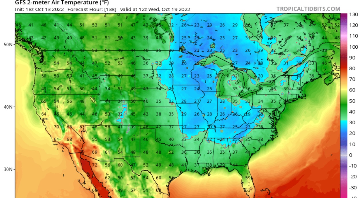
A cold front moving through the region this week has brought rain and cooler temperatures to the Southeast the past few days. A second, stronger cold front is expected this weekend, and that will usher in even colder and drier air by Tuesday morning. As the cold air settles in, it could get even colder on Wednesday morning October 19, with some areas experiencing frost. Some areas that are prone to frost may even see a hard freeze. Temperatures as far south as northern GA and AL could reach as low as the mid-20s. This is about a month earlier than last year, so if you have tender plants that are susceptible to frost or freeze, you will want to watch the forecasts carefully and plan any responses ahead of time. The map below is from the GFS model, which is a little more aggressive with the low temperatures than other models, but still within the range of possibilities. The forecasts are likely to change over time, so keep watching. If you have frost pockets in your fields, those will experience freezing temperatures due to cold air drainage even if other areas are missed.