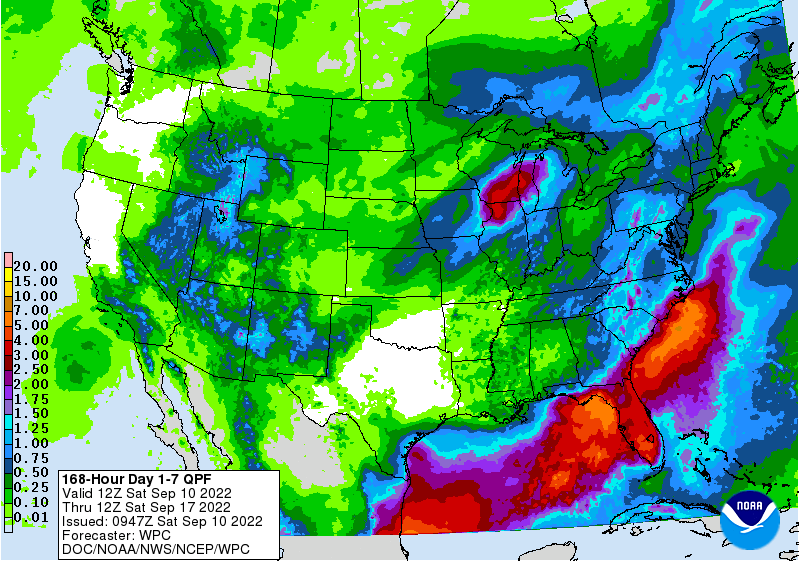
The latest 7-day QPF map shows that it should be a rainy weekend for most of the region, dumping showers on many football games and other outdoor activities. By Monday night a cold front is expected to move through the region, bringing cool and dry conditions to most of the region with the exception of Florida and coastal areas where the front may stall. It’s going to feel a bit like fall for a few days before we start to warm up again. Week 2 looks like a return to warmer than normal conditions and it could be quite dry too, depending on the tropics. The driest area is expected to be central Alabama, while the wettest region is expected to be most of the Florida peninsula and Southeast Georgia. The tropics are quiet for now, but sometimes a storm will spin up along an old front, so forecasters will be watching that closely, since the Gulf and Atlantic sea surface temperatures are quite warm.