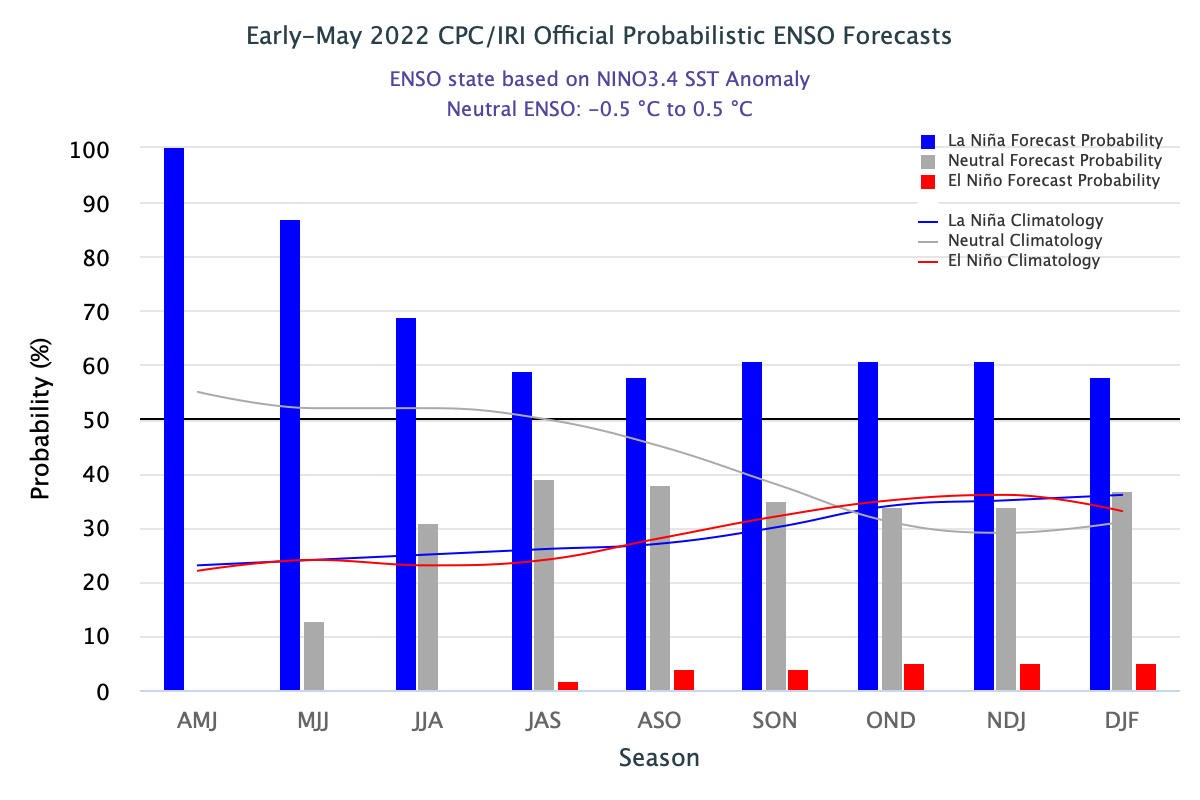
The latest La Nina outlook was released by NOAA today. It shows that La Nina is remaining strong and is now the most likely state of ENSO (El Nino Southern Oscillation) to continue through the summer and into the fall. This means that if this forecast is good, we are likely to see warmer and drier conditions across the southern tier of the United States for the next few months. But keep in mind that outlooks made this time of year are generally less accurate than in other parts of the year due to the spring predictability barrier, which makes good forecasts difficult. You can read more about this in the latest ENSO blog at https://www.climate.gov/news-features/blogs/enso/may-2022-enso-update-piece-cake.
In the Southeast, the wild card is the Atlantic tropical season, since La Nina years are also associated with more tropical systems than usual. If the storms track near or make landfall in the Southeast, then those areas near the path of the storm will be likely to see enough rain to fend off any drought, whereas areas that are farther from the path of any storms will be more likely to see drought establish or expand due to the lack of rain. It’s going to be an interesting summer, for sure.