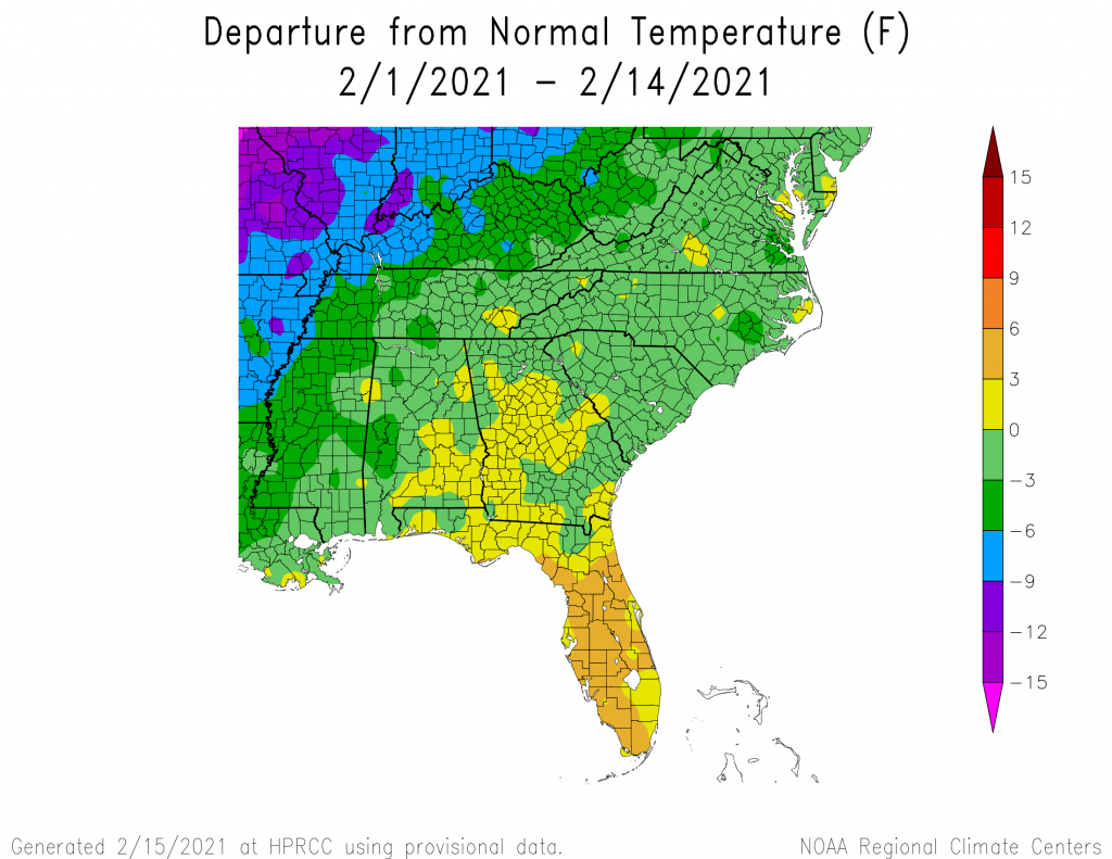
We are halfway through February, so I thought I would take a look at the climate so far this month. The temperature departure map shows that the southern half of the region is above normal for the month except for a few areas where the rain was the heaviest. This is what we would expect from a La Nina winter. The precipitation departure shows that the storm track where most of the rain has occurred so far this month has been pushed to the south into the area that is normally dry in a La Nina winter, leaving other areas like Alabama and northern Georgia quite dry. The storm track was shifted south this winter by the polar vortex slipping towards us from its location near the North Pole, which in turn was caused by a sudden stratospheric warming event that occurred early in 2021. This movement of the polar vortex pushed the storm track to the south as well. I have heard many comments about the bad climate forecast, which was based on expecting a more typical La Nina pattern. Climate forecasts are generally made using the statistics of what is most likely to happen, but this year just happens to be a year when the statistics don’t capture what is actually happening very well. Meteorologists see similar complaints with probability of precipitation (PoP) forecasts. If they predict 20 percent chance of rain and you are the one that experienced it, you might complain that the forecast PoP was too low, even if four of your friends in surrounding areas had no rain. If we have another La Nina next winter (which is being picked up by some of the long-range ENSO forecasts), don’t expect it to look much like this one. It could, but statistics would argue otherwise.