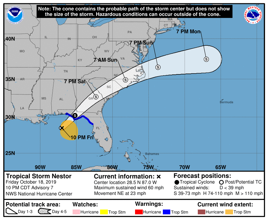
The latest track of Tropical Storm Nestor just came out at 11 pm EDT, and shows that the center of Nestor is likely to make landfall early tomorrow morning, just two or three hours after my blog digest comes out. Nestor is a lopsided storm, so a lot of the rain will be out ahead and to the right of the center of circulation. Most of southeastern Georgia will experience 2-4 inches from the storm, while areas that are farther north and west will see less. Winds near the center could gust to 50 mph or more, especially near landfall.
Nestor is moving pretty fast so the weather from the storm could last only a few hours, although areas in the rain shield could see rain for many hours before the storm approaches. Radar show that the outer bands of rain are already onshore along the Gulf Coast, and a few small tornadoes have already been observed on radar. Here in northern Georgia we had the benefit of Nestor tonight in the form of a spectacular sunset thanks to all the high and mid-level clouds present ahead of the storm. By the end of the day on Saturday Nestor should be out of Georgia and headed through the Carolinas.