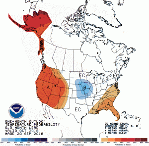
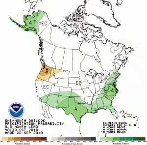
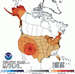
The latest set of temperature and precipitation outlooks was released today by the Climate Prediction Center. They show that for October, the forecasts are leaning towards wetter and warmer than normal conditions. This is basically a continuation of the last few months. The outlook for the rest of 2018 shows that most of the Southeast will continue that pattern, although there is an area in southern GA and SC, southeastern AL and northern FL that has equal chances of below, near, and above normal temperatures. This is due to a conflict between generally warming trends across the region and the cooling that is expected there due to what we think will be an El Niño. I’ve read today that some scientists are starting to wonder whether El Niño will develop at this point but most climatologists are still thinking it will cross the threshold from neutral conditions soon. If you want to see all the long range forecasts you can visit https://www.cpc.noaa.gov/products/predictions/90day/.
If you are tired of hot weather, I do have one spot of cool relief. The 8-14 day temperature forecast is showing a big push of cold air out of Canada moving through the middle of the US, and some of us may see at least temporary relief from the above-normal temperatures we are currently experiencing. In fact, farmers in the northern US are expecting some frost out of this system (see AgWeb article here).


