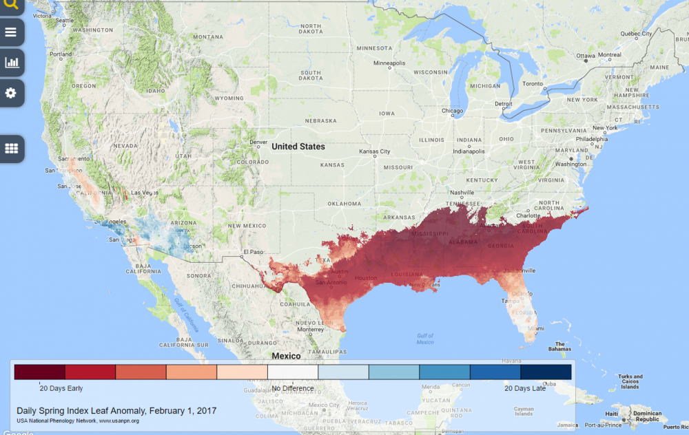
According to the USA-NPN’s Spring Indices, spring is arriving 20 days earlier than a long-term average (1981-2010) in much of the Southeastern US. The Extended Spring Indices are models that predict the onset of early spring plants across the United States. You can see these maps as well as maps of Accumulated Growing Degree Days (AGDD) on the USA-NPN’s Phenology Visualization Tool. You can read more at https://www.usanpn.org/news.
USDA points out that this may mean problems for farmers in the Midwest as well as the Southeast, according to their article at https://www.climatehubs.oce.usda.gov/content/possible-early-spring-may-mean-potential-damage-crops. The early spring may make plants in both the Southeast and the Midwest vulnerable to a late-season frost. This year with a weak-to-nonexistent La Niña, we have a better chance than usual of getting one of these late frosts after a warm period, which is especially worrisome.
Another concern is the increased demands on water from plants that are now actively growing ahead of schedule. As long as the plants are dormant, their water needs are minimal and most rainfall can go to replenishing soil moisture and reducing drought. But once the plants start growing they are very active at pulling water out of the soil. This will have the likely effect of reducing both soil moisture and stream flows as water is pulled by plants into the air instead of moving into the soil and then into streams and lakes. This could mean a quicker return to drought if warm and dry conditions return to the region in spring.