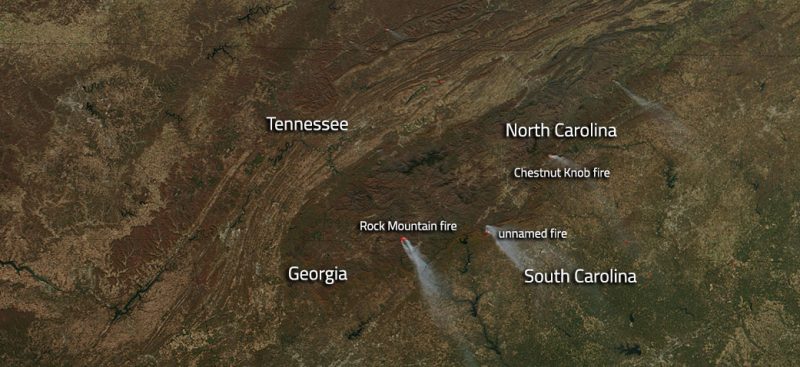
Wildfires are still raging across the Southeast. You can see a recent satellite picture at EarthSky at https://earthsky.org/earth/southeastern-us-wildfires-tennessee-northcarolina-southcarolina-georgia-nov2016. Some areas are so smoke-filled and potentially hazardous that people have been evacuated, for example in Rabun County GA according to WGAU here and the Atlanta Journal Constitution here.
Eos.org reported this week on some research being done on studying climate-fire interactions using NASA’s MODIS satellite. The MODIS satellite is a low-orbiting satellite that circles the Earth multiple times per day, allowing scientists to watch the evolution of the fires and determine how they are moving even in remote areas that don’t have direct surface observations. In doing this they can supplement other reports as well as look at regional differences in fire behavior. You can read more about it at https://eos.org/research-spotlights/fighting-fire-satellite-data.
I will note that the MODIS project from NASA is one that is facing uncertainty under the upcoming administration of President-Elect Trump. He has said that NASA’s proper focus should be outward towards space and not inward towards Earth. It’s not clear what this means for the future of programs like MODIS–it could be moved to another agency, it could be continued as is, or it could be cut. I have friends who are NASA scientists who are anxious about the uncertainty of what could happen to this and other NASA programs in the future. To me, NASA’s earth-monitoring programs are a vital part of watching weather and climate globally and I would hate to see them cut or stymied in producing their excellent science research. Here is an article that discusses it at the (somewhat partisan) Guardian if you would like more information.