The blog at Climate.gov posted a new discussion of the current unusual mid-year El Nino and how it might evolve over the next few months. It is available here. The article discusses how this El Nino has come on much more slowly than most El Ninos in the past, which makes it a bit harder to trust the forecasts for exactly how strong it will get. But both statistical and dynamical models agree that it has a 90 percent chance of lasting through the summer and an 80 percent chance of lasting through next winter.
You can see 3-month composites of the expected temperature and precipitation impacts on the US climate at https://www.cpc.noaa.gov/products/precip/CWlink/ENSO/composites/. The composites show that if El Nino lasts through the winter, we can expect to see cooler than average temperatures in the last quarter of 2015. A dry spell in the July-August time span is possible due to the expected inactive tropical season in the Atlantic before wet conditions return later in fall and into winter. You can also see monthly anomalies at https://agroclimate.org/tools/Climate-Anomalies/.
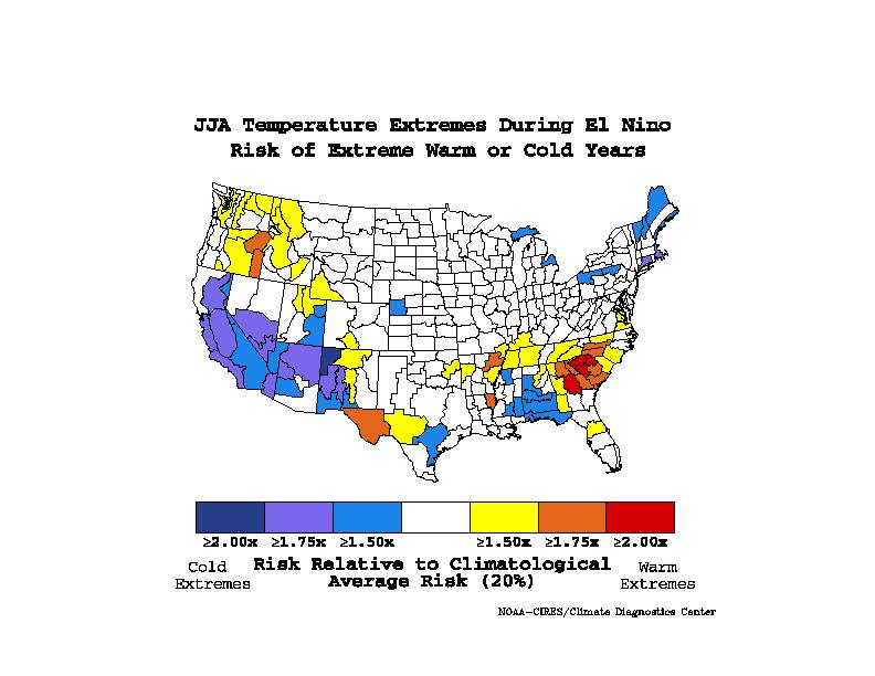
The National Weather Service office at Columbia SC also pointed out on their Facebook page that the chance of a warm extreme spell in June-August is much larger in an El Nino than a non-El Nino year. The Weather Underground blog has more information about what makes this El Nino so unusual at https://www.wunderground.com/blog/JeffMasters/comment.html?entrynum=2989.