Last night parts of the Southeast experienced their first snowfalls of the year. A few areas in Georgia received over an inch, such as Fannin County, and many people sent in photos to the National Weather Service showing the snow that fell at their locations. Some areas in South Carolina received over 6 inches of wet snow and experienced many broken tree limbs and treacherous driving. This snow was associated with an unusually strong upper atmospheric low pressure which moved north to south over the area on Friday. The cold air associated with the low caused instability showers and snow to accumulate at higher elevations, in more northern locations and near the center of the low pressure area. Winds on the rear side of the circulation were from the northwest and very strong. One consequence of the wind direction was to create an area of clear skies downwind of the mountains which left Atlanta in clouds but Athens in clear, sunny conditions (see arrow on satellite map). The winds flowing down the slope on the southeastern side of the Appalachians caused warming and drying of the air, which dissipated the clouds in this local area while other areas remained cloud-covered.
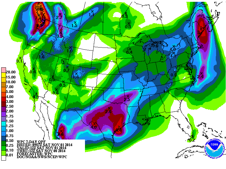
The low pressure area is expected to spin up a coastal low pressure area which will travel to the northeastern US, causing a large area of rain and potentially some snow to fall over that region. Here in the Southeast, we should see little to no rain for the next week once the upper level low moves out of the area.