Harvest has been progressing this week in Worth County, and many growers are busy in peanuts and cotton. Following are some thoughts that Dr. Pam Knox, Director of the UGA Weather Network shared today.
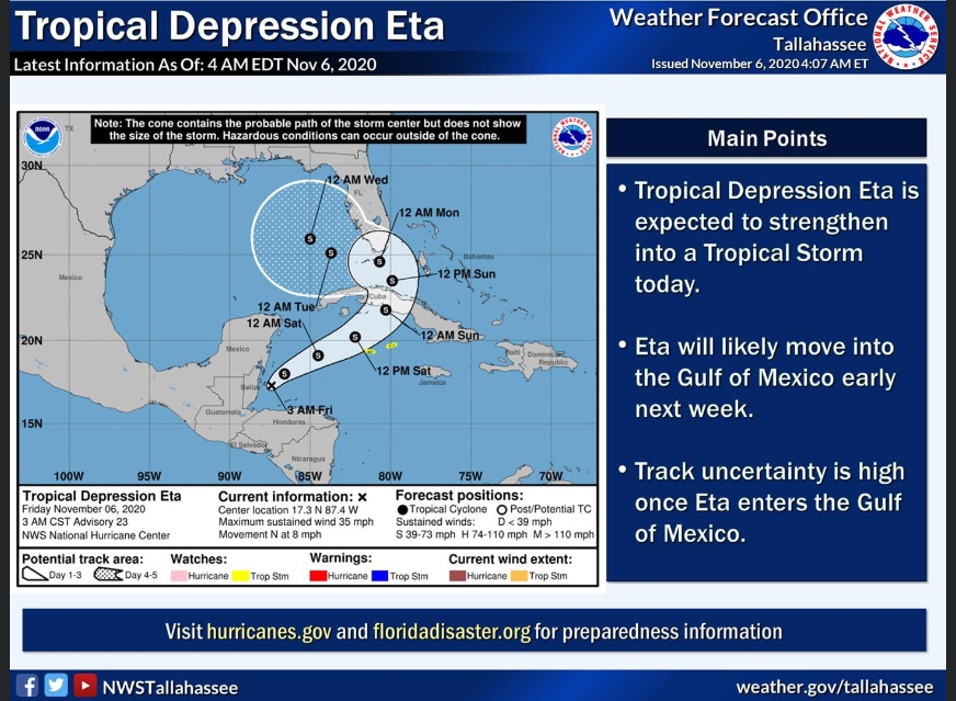
“If you have been following the weather news, you know that Hurricane Eta made landfall on Nicaragua earlier this week and has been meandering north through Central America. It is now back out over the warm Caribbean Sea and is moving north. It is expected to pass over Cuba and to affect southern Florida this weekend. After that, the expected path turns west in the Gulf of Mexico. While there is a lot of uncertainty about where it will go after that, we can expect to see impacts in Georgia, mainly in the form of more rain. This time, the most likely region to see effects is southeastern Georgia, but since the path is so uncertain at this point, you should all be keeping an eye out. The storm will merge with an oncoming front, which could increase the amount of rainfall. The southeast coast could see rain as early as this weekend, while the rest of Georgia is likely to see rain by Wednesday.”
“This is not expected to be a strong storm, but rain could hamper harvest plans, and even moderate winds are probably not good for any cotton that has not been harvested yet. This should be a nice weekend for getting things done.”
Below is a snapshot of the forecast from this morning.