Drought
-

There have been a lot of stories about heat and drought across the world over the last couple of weeks. Here are some of the ones that I thought were the most interesting. The Guardian: In California’s interior, there’s no escape from the desperate heat: ‘Why are we even here?’ Idaho Statesman: Amid drought, thousands…
-

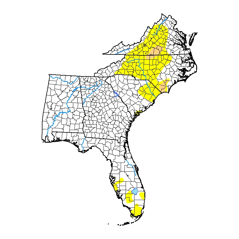
This week’s Drought Monitor map shows that there is still moderate drought (D1) and abnormally dry conditions (D0) in the Carolinas and Virginia. The map was produced with a cutoff of Tuesday, so the rain that is falling there today will probably reduce the dry conditions in next week’s map. Florida’s dry conditions were significantly…
Posted in: Drought -
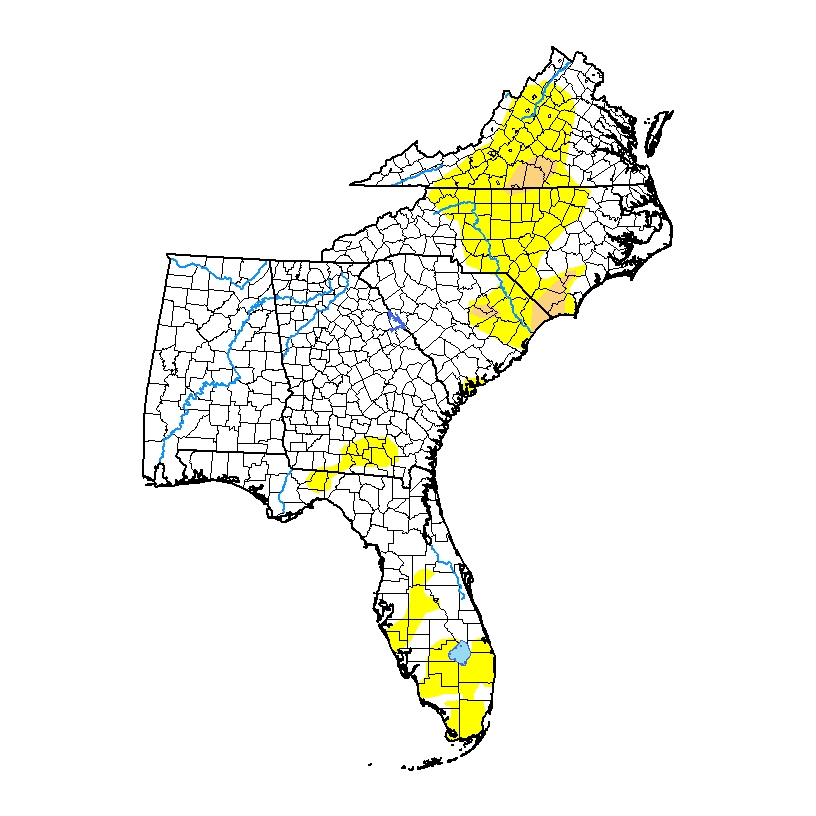
The latest drought map, released this morning, shows that abnormally dry conditions now cover quite a bit of central North Carolina. Moderate (D1) drought has expanded there and also slightly in Virginia. All abnormally dry conditions have been removed from Georgia and are reduced in Florida and South Carolina. Rain this weekend and potentially next…
Posted in: Drought -
Recent rains have put a dent in dry conditions and drought across the Southeast this past week. The rains, from the remains of TS Claudette and a strong cold front, reduced drought in the Carolinas and Florida. Moderate (D1) drought expanded slightly in Virginia, although overall dry conditions were reduced. With not much rain expected…
Posted in: Drought -

You’ve probably heard the term “flash drought” many times. But do you know what it is? If not, here is your chance to find out. The National Integrated Drought Information System (NIDIS) is hosting a webinar on flash drought on Tuesday, June 22, at 2 pm EDT. You can get more information and register for…
-
The Drought Monitor web site has been having some problems recently, so today’s drought map is from Drought.gov, its sister site. Because of recent rains, drought conditions improved there this week. They could see more improvement next week with rain from potential Tropical Storm Claudette, which is pulling itself together in the Gulf. Even if…
-
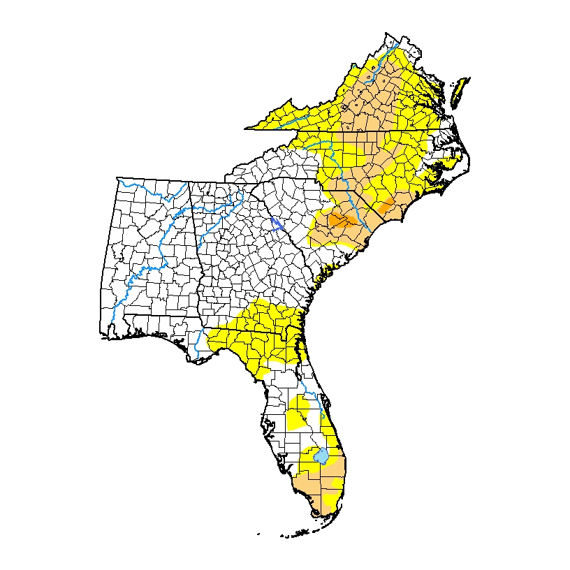
The latest Drought Monitor, released today, shows that abnormally dry (D0) conditions expanded in parts of Florida and in southern Georgia, but the severe drought in North Carolina decreased due to rain there this week. Rainfall this coming week could put a dent in both parts of the region, although other areas will not see…
Posted in: Drought