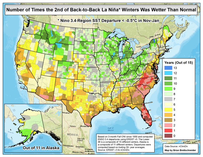
As you know if you read this blog, the chance of going back into a La Nina later this year from our present neutral conditions is very high. Last year was also a La Nina winter, and while we expected it to be warmer than normal based on long-term statistics, it was the one out of about ten years when that did not happen. That was primarily due to a Sudden Stratospheric Warming (SSW) event that occurred in early January that brought an outbreak of cold air to the central US. It also cooled us down in the Southeast, although the effects were smaller here than in Texas and other states in the Central Plains. Today Brian Brettschneider, a climatologist from Alaska, posted a statistical study showing that in the second year of a back-to-back La Nina like the one we are headed for, in about 10 out of 15 years, the second winter is above normal in temperature everywhere except Florida. Those odds are not quite as good as the first year, but still something to watch. I encourage you to follow @Climatologist49 on Twitter if you like to see these kind of statistical analyses, because he does a lot of them! A second graphic shows that the likelihood of a wetter than normal winter is very unlikely.