The content on this page is retained only for recordkeeping, historical reference, or research. These materials are preserved in their original form and may not meet current WCAG 2.1 AA accessibility standards.

These archived materials are not required to be remediated. However, we remain committed to equitable access. If you need an accessible version of any archived item to participate in our current programs and services, we will provide one when feasible upon request at caesweb@uga.edu.

Cliff Mass of the University of Washington posted a long article on his blog this week describing the atmospheric and oceanic conditions which have led to the unusual conditions for the past two years.  While his blog is focused on the Pacific Northwest, much of his analysis also applies to the Southeast, with the caveat that Washington state was under the high pressure ridge of the large scale atmospheric pattern these past winters and the Southeast was under the other end, the trough of low pressure that allowed cold air to enter our region from Canada and even Siberia.
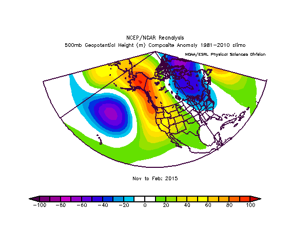
Source: National Center for Environmental Prediction