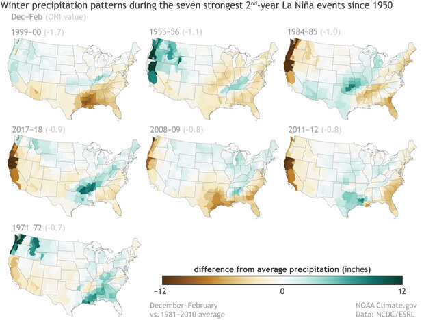
NOAA released their winter outlook in late November. It provides a detailed look at what to expect knowing that we are now in a La Nina that should last through the winter and into spring. You can see maps of the climate variations in each of the first- and second-year La Ninas over the last 50 years or so to see how they vary from one event to the next, and learn what that says about our likely conditions this coming winter. You can see each episode is different but some statistical patterns emerge showing that for a lot of the Southeast, the winter is likely to be warmer and drier than normal, a typical La Nina pattern, but not one that occurs every time. You can read the complete analysis at: