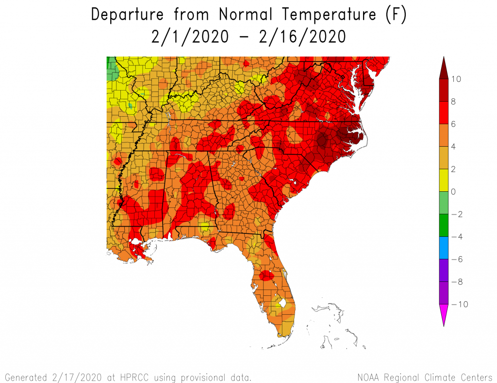
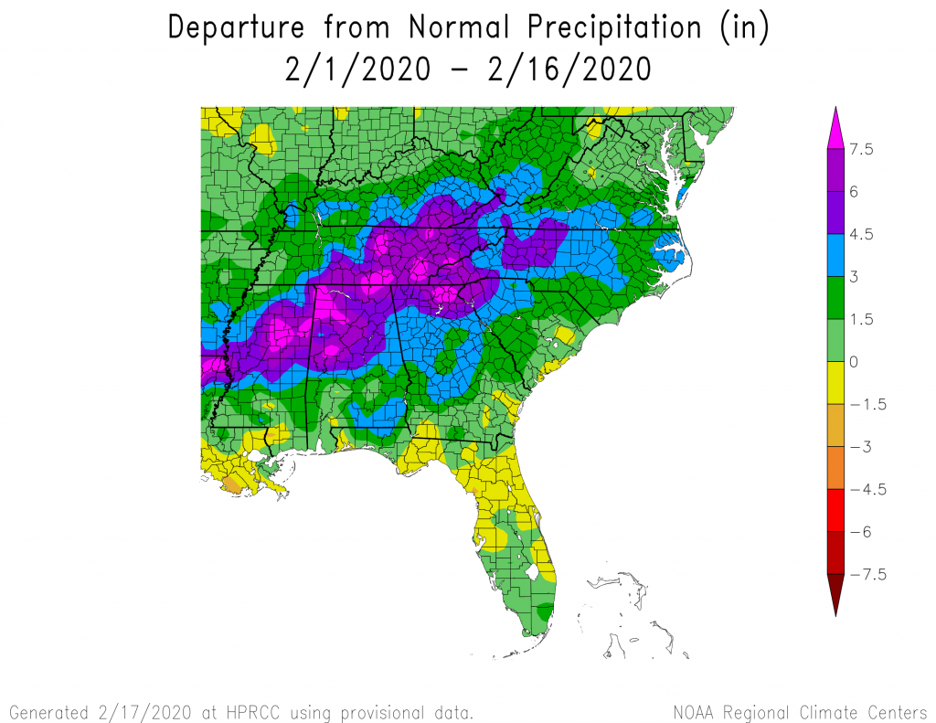
The month is halfway over, and for most of the month we have been locked in a pattern of wet conditions in northern sections of the Southeast and dry conditions in Florida and southern Georgia. Unfortunately for both regions, this pattern is expected to continue for another 1-3 weeks while the really cold air is trapped up in the Arctic, blasting Alaska with near-record-setting cold temperatures. This means that the abnormally dry conditions and drought in parts of Florida are not likely to go away, at least in the near term, although the Climate Prediction Center still indicates removal is likely over the longer term. Flooding could happen repeatedly with each new rain event in the northern regions, as well.
With the warmer than normal temperatures that we are experiencing in the region, plants are coming out of dormancy and water demands are expected to rise rapidly. We are seeing an increase in pollen that also indicates the plants are waking up. The season is running two to three weeks ahead of normal because of the warm winter conditions, so this is not surprising. But it is worrisome for fruit farmers, since if the polar vortex does break down and releases polar air towards the Southeast, we could see a frost that could devastate the blooming plants. I don’t see anything like this happening in the foreseeable future, but we are not out of the cold season yet, so I will be watching closely.