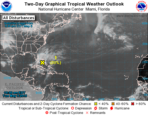
Earlier this week I noted the potential for an early start to the Atlantic tropical season. Today the National Hurricane Center issued this statement about the potential for development:
“A large area of disorganized showers and thunderstorms extending from the northwestern Caribbean Sea across Cuba, southern Florida, and the Bahamas is associated with an upper-level trough and a weak surface trough. An area of low pressure is expected to form in association with this disturbance during the next day or two. The low could gradually acquire subtropical characteristics over the next few days while it moves generally northward at a slow forward speed. For additional information on this system, see High Seas Forecasts issued by the National Weather Service. The next Special Tropical Weather Outlook will be issued on this system by 11 AM EDT Wednesday.
* Formation chance through 48 hours…low…20 percent
* Formation chance through 5 days…medium…40 percent”
While most of the Southeast is unlikely to be affected by this potential tropical storm, the coastal areas along the Atlantic Ocean and in the eastern Carolinas could be affected. If the steering currents are light, it is even possible that the storm could drift west into Georgia or South Carolina, but it would mainly bring rain and some gusty winds to the area. If you are in the affected area, you will want to keep an eye on future forecasts to see how the storm evolves.