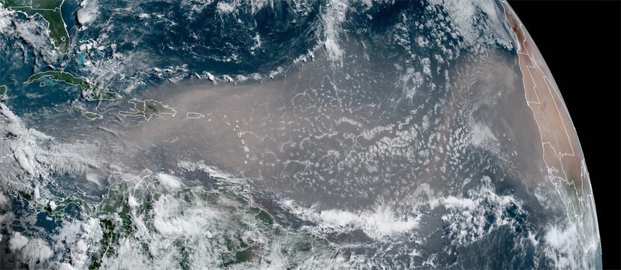
If you follow the news at all, you know that a lot of the Southeast is expected to experience the effects of a very large plume of dust blowing west off the Sahara desert all the way across the Atlantic Ocean and into the Southeast. Because of the weather pattern right now, it will probably miss Florida and enter the Southeast from the south and southwest as the dust plum curves north and then east. While it’s not that unusual to have these plumes of dust blow off of the Sahara, this one is a lot bigger than most. Some of the effects we are likely to see are a reduction in tropical activity (due to the dust aloft, which is heated by sunlight and stabilizes the atmosphere), some increase in air pollution and associated asthma, and extra-colorful sunrises and sunsets. It might also cause some reduction in convection in the central US because that dust could also stability the atmosphere over land. The initial edge of the dust is getting close to the US now and we should start to see it start to impact us in the next few days. You can read more at Yale Climate Connections here or search the news online.