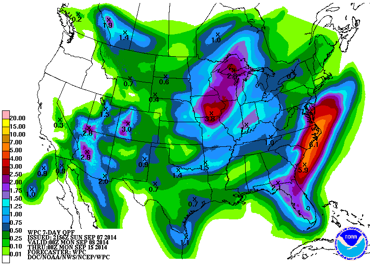
The 7-day QPF map below shows that northern Georgia and much of Alabama will receive below normal rainfall (normal is roughly an inch a week) but southern Georgia into Florida and the eastern Carolinas should receive more rain this week. The heavier rains in Georgia are predicted to fall over the areas that are now in severe drought, so that should keep the drought from expanding this week in southern Georgia, although it might expand farther north. QPF stands for Quantitative Precipitation Forecast and the map shows the number of inches of rain that is expected over the next seven days, using the colored key at left. You can find this map for yourself along with QPF maps for other time periods at https://www.hpc.ncep.noaa.gov/qpf/day1-7.shtml.