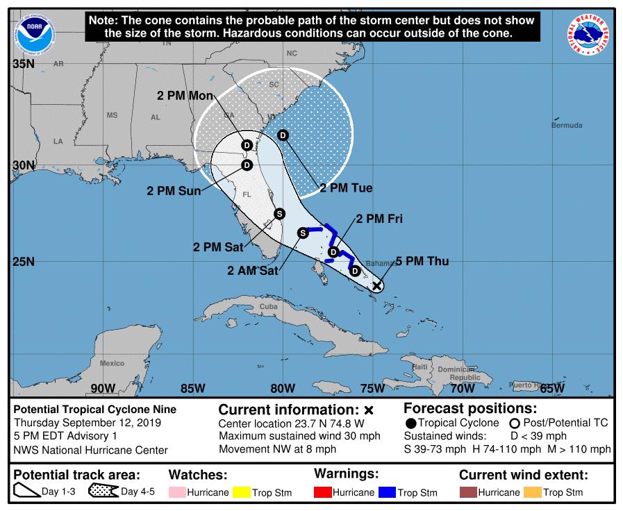
A Potential Tropical Cyclone notification has been issued by the National Hurricane Center for the likely development of a tropical storm (most likely named Humberto, the next name on the list) in the next day or two. The models have been all over the place with this because it has been such a disorganized system, but the current projected path is for it to approach the east coast of Florida and travel over parts of Florida and southeastern Georgia before heading back out to sea to the northeast. Almost none of the models is showing that this is likely to become a hurricane, so the most likely impacts are some gusty winds on Sunday into Monday and heavy rain in some places but especially east of the path of the storm. We could actually use some rain because of the increasing drought (see my post earlier today), so the rain at least should be welcome. However, rain and wind over the Bahamas as they are trying to recover from Hurricane Dorian will not be welcome and will hamper recovery efforts.
If you need dry weather to harvest cotton or bale hay, you will want to keep a close eye on this since it could affect those plans by this weekend. However, the rain could soften the ground, improving harvesting conditions for peanuts.
For more information, you can read Weather Underground here and Kirk Mellish of WSB here. Note that because there is no closed low at this time, predictions about where it will go are more uncertain than in better developed storms.