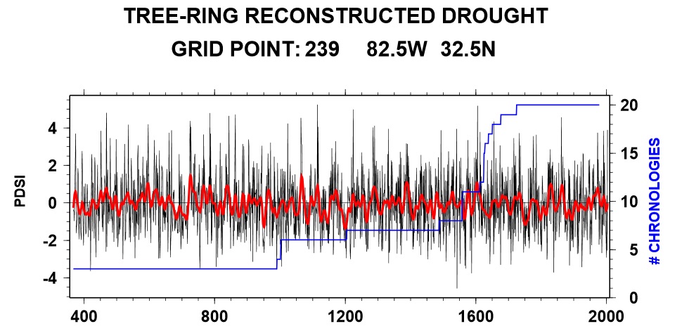
In the conference I’m attending today, one of the speakers presented PDSI data derived from tree rings going back to about 400 AD. It is presented as a series of grid points across North America. If you are interested in a longer-term perspective on climate that goes back farther than the instrumental records, you might want to check it out.
Here is the link to the atlas:
https://iridl.ldeo.columbia.edu/SOURCES/.LDEO/.TRL/.NADA2004/.pdsi-atlas.html
The graph below shows the time series for the grid point in east central Georgia. It shows that the last century has been relatively wet compared to some periods in the past, particularly around 1200 AD.