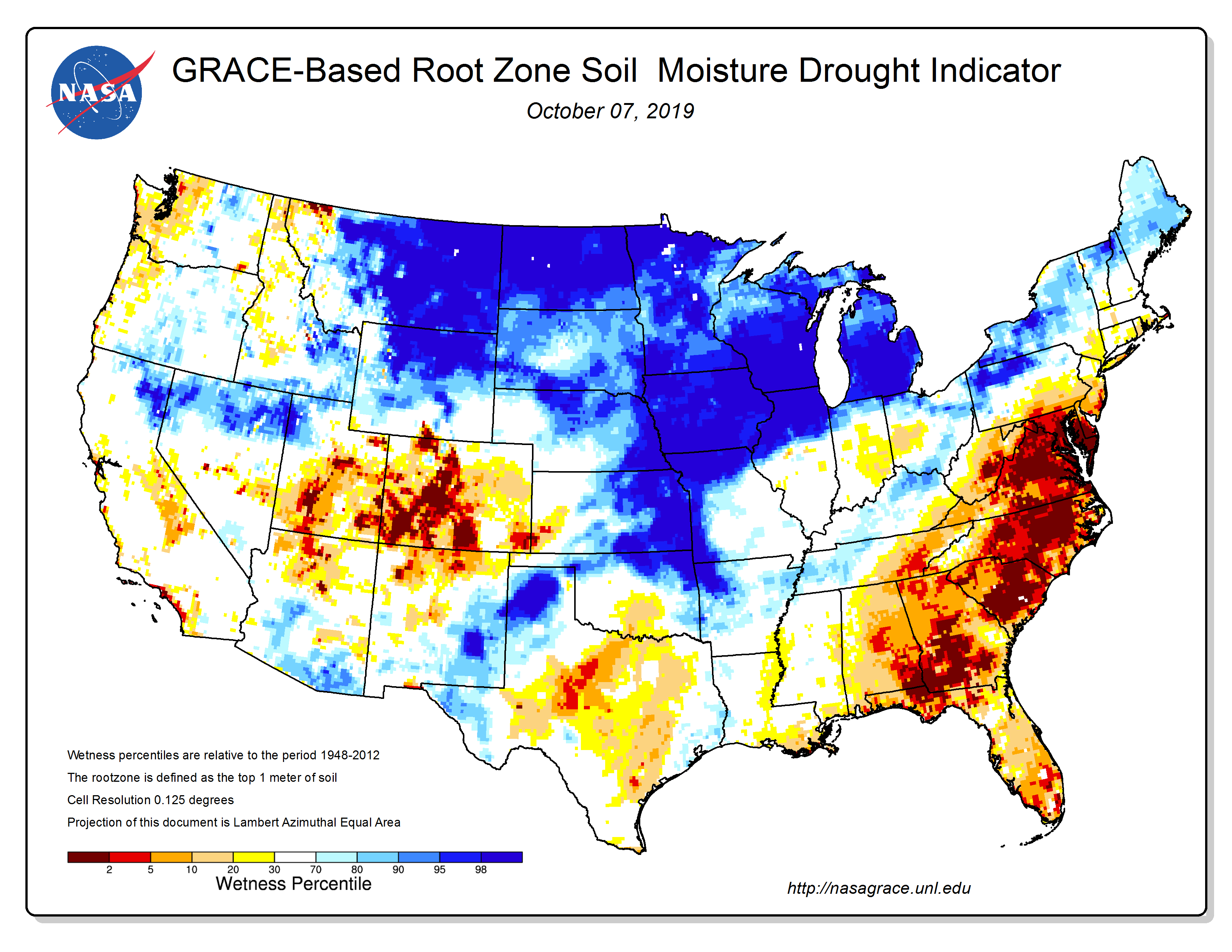
The use of satellites to monitor climate conditions provides some really good fine-scale detail about how conditions like soil moisture are changing over time. The NASA GRACE tool provides a look at soil moisture depletion in several different zones, including the root zone. This map from last week shows how dry the root zone is in the Southeast. No wonder we are in an agricultural drought! You can find this indicator map along with other drought indicators at the Drought Monitor Tools page at https://drought.unl.edu/droughtmonitoring/Tools.aspx or you can go directly to the GRACE map at https://nasagrace.unl.edu/.