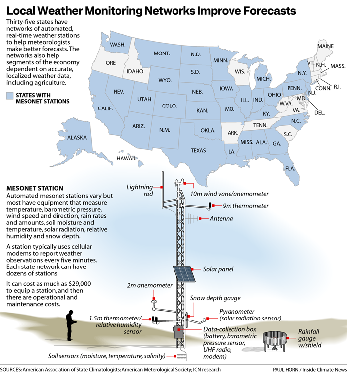
Inside Climate News published a story about state weather mesonets in February, but I just ran across it this week. Mesonets like the one we have at the University of Georgia provide valuable climate information to farmers and extension agents documenting drought, water stress, freezes, and growing degree days, all of which help farmers monitor their crops. But state mesonets also provide added information to the National Weather Service, and that helps them get severe weather warnings out in a timely way that can save lives because it provides more local data for forecasters to use when severe weather is occurring. In fact, our station in Byromville helped document the strength of an EF-2 tornado when it got hit by the developing storm on April 5. The map below shows which states have state mesonets, although some states have more than one.