The content on this page is retained only for recordkeeping, historical reference, or research. These materials are preserved in their original form and may not meet current WCAG 2.1 AA accessibility standards.
These archived materials are not required to be remediated. However, we remain committed to equitable access. If you need an accessible version of any archived item to participate in our current programs and services, we will provide one when feasible upon request at caesweb@uga.edu.
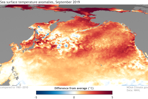
When we look at sea surface temperatures in the Pacific Ocean, we are commonly looking for signs of El Niño or La Niña, which can greatly affect the climate of the Southeast, especially in winter. But recently the most interesting part of the Pacific has not been near the equator where we usually see ENSO signals but farther north, where nearly all of the North Pacific Ocean is well above normal in temperature. How does this compare to the large warming we saw in 2016 and it is expected to occur more frequently in the future? You can learn more in the El Niño blog here.
Sea surface temperature anomalies during September 2019. Red/orange shading indicates above-average temperatures and blue shading indicates below-average temperatures. Climate.gov image based on NOAA NNVL and NCEI.