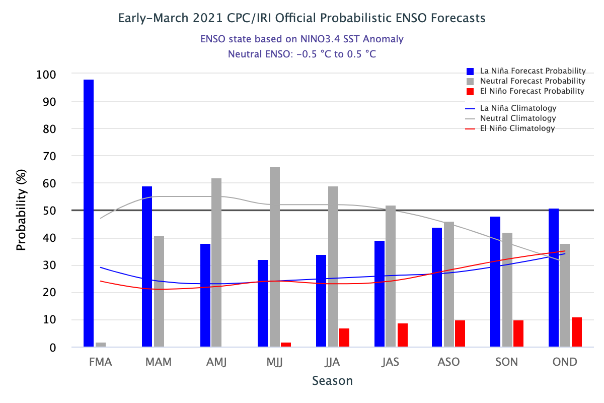
The latest ENSO outlook was released today. It shows that La Nina is still hanging on now, but that neutral conditions are expected to return later this spring and last through summer. The current forecast for next fall and winter is for La Nina to return in a “double dip”, which happens fairly frequently with La Ninas and almost never with El Ninos. There are no strong climate signals in temperature and precipitation in the summer from neutral conditions, but typically the Atlantic tropical season is more active when either La Nina or neutral conditions are present compared to El Nino years due to a weaker subtropical jet. That allows tropical waves grow vertically and develop into tropical systems more readily than with a stronger yet. You can expect that to be reflected in forecasts for the number of Atlantic tropical storms and hurricanes that will come out later this spring. You can read NOAA’s discussion here.