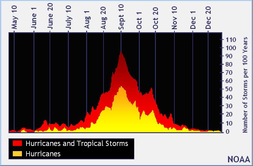
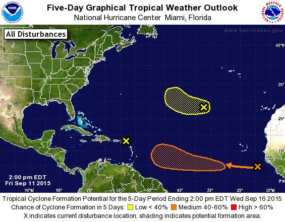
September 10 marks the middle of the Atlantic tropical season, as seen in the graph below. Today we are up to storm H for “Henri”, which is headed northeast and poses no threat to the US. There are currently three “X’s” in the Atlantic, with one at 50% chance of developing into a tropical cyclone in the next five days (if it becomes a named storm, it would be Ida, #9 for 2015).
(Late update: Henri has dissipated and only a few spinning clouds are left as of 8 pm on Friday.)
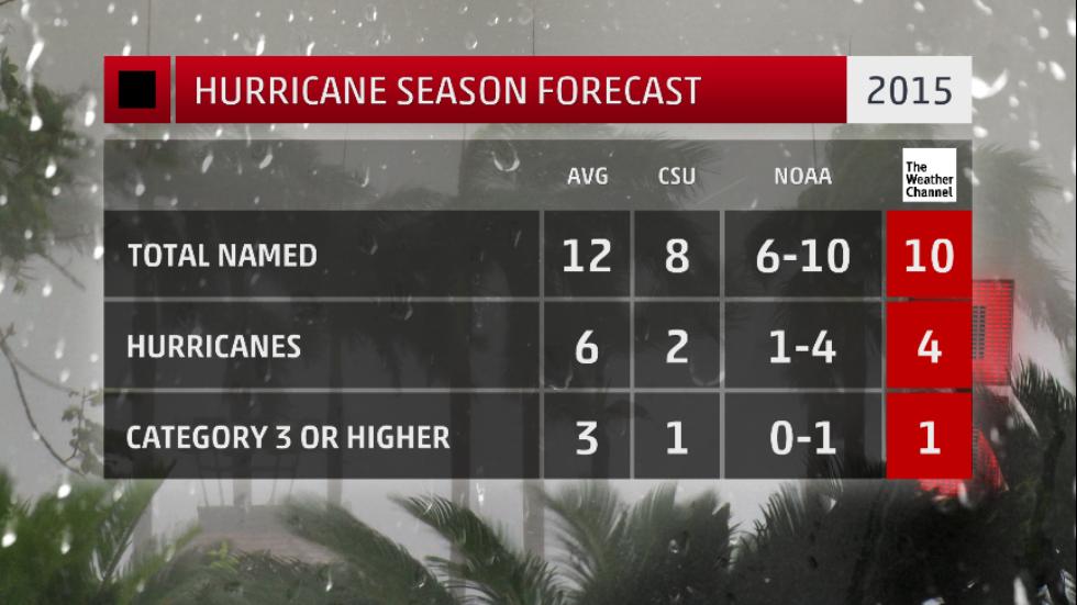
All of the forecasts this year predicted a fairly quiet hurricane season, with 6-10 named storms, 1-4 hurricanes, and 0-1 major hurricanes, according to NOAA. We’ve already had 8 named storms, including one hurricane, Fred, which was very small. Many of the storms were not able to develop to hurricane intensity because of cooler water, interactions with land, and the persistent strong wind shear associated with the current El Nino.
What will the second half of the season bring? Wind shear continues to be a problem for the storms, and water temperatures are now declining across the Atlantic with fall coming, so there may be less to worry about later this season. But we can have storms all the way up to the end of November (and occasionally after that), so you still need to keep an eye out for late bloomers.