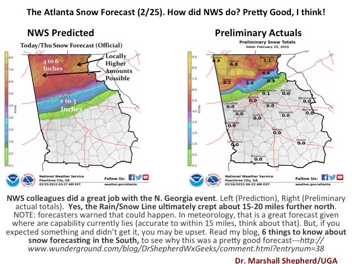
After any winter storm, armchair meteorologists complain about how bad the forecast was, how the National Weather Service and broadcast meteorologists blew it, and how disappointed they are. Dr. Marshall Shepherd, UGA Geography professor, put together this side-by-side comparison to show that in this very tricky situation, the NWS did a fantastic job of getting the forecast right, even though some areas right along the transition from “snow” to “no snow” did not get the winter precipitation they were hoping for or expecting.
Winter precipitation is the toughest thing that meteorologists have to predict, because it depends not only where a single degree of temperature (32 F) is located (because it controls whether water is liquid or solid) but also the vertical structure of the atmosphere (which determines snow from sleet from freezing rain). And in an evolving, not static situation, where air is moving in from many directions. You can read Dr. Shepherd’s comments about winter forecasting at his blog here.
For more on forecast accuracy in perspective, you might be interested in this blog posting from meteorologist Brad Panovich, a broadcast meteorologist in Charlotte NC (link).