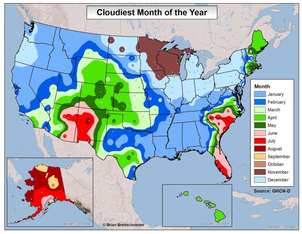
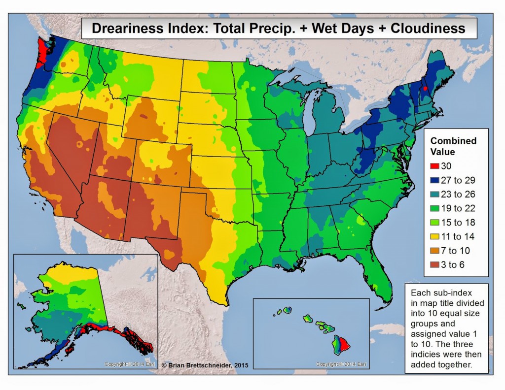
According to my friend John Feldt of Blue Water Outlook, we are entering the time of year which is historically the cloudiest for the majority of the United States. Where I grew up in Michigan and Wisconsin, late fall and early winter was typically the cloudiest, in part due to the passage of frequent low pressure areas and also partly due to the effects of the Great Lakes across that region. Here in the Southeast, we have a different pattern. For areas along the East Coast, including the Florida peninsula, the cloudiest months of the year are in early summer, no doubt due to storms driven by the local conditions there. For areas farther west, including western Georgia and all of Alabama, the cloudiest month is January. John also introduced me to a new index called the “dreariness index”, which combines the total amount of precipitation, number of wet days, and percentage of cloudiness into one numerical index based on comparisons across the US. The winners for most dreary conditions are the Washington state coast and area around Mount Washington in New Hampshire plus the Alaska southeast coast and the windward side of Hawaii’s Big Island. If you like sunshine, the clear winner is the American Southwest.