Today marks the first day of summer for meteorologists. Summer is officially June, July and August in the climatologist’s calendar. It is also the first day of the Atlantic tropical storm season, which looks like it could be a bit more active than usual.
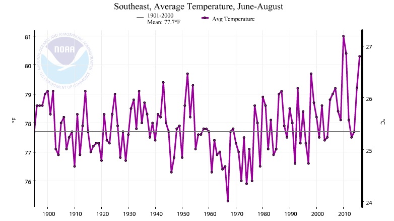
Here’s a graph showing the average temperature trend for the Southeast as a whole since 1895. If you break down the difference between daytime max temperatures and nighttime min temperatures (you can do it at https://www.ncdc.noaa.gov/cag) you will see that a lot of the warming is due to increases in temperature at night, with less contribution from daily highs. This is a problem for livestock, who need cool nights to recover from hot days, and for some crops which don’t do well when nights stay warm. Note that while there are a few cities in the record which may contribute a minor amount of urban heat island effects, the majority of records come from rural areas which would not be affected by urbanization.